You are here: Home > Network List > TA - USArray Transportable Network (new EarthScope stations) Stations List
> Station I23K Minto, Yukon-Koyukuk, AK, USA > Earthquake Result Viewer
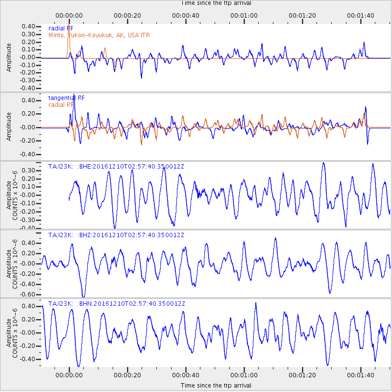
I23K Minto, Yukon-Koyukuk, AK, USA - Earthquake Result Viewer
*The percent match for this event was below the threshold and hence no stack was calculated.
| Earthquake location: |
Solomon Islands |
| Earthquake latitude/longitude: |
-10.9/161.3 |
| Earthquake time(UTC): |
2016/12/10 (345) 02:45:40 GMT |
| Earthquake Depth: |
10 km |
| Earthquake Magnitude: |
5.5 mb |
| Earthquake Catalog/Contributor: |
NEIC PDE/us |
|
| Network: |
TA USArray Transportable Network (new EarthScope stations) |
| Station: |
I23K Minto, Yukon-Koyukuk, AK, USA |
| Lat/Lon: |
65.15 N/149.36 W |
| Elevation: |
149 m |
|
| Distance: |
84.2 deg |
| Az: |
18.798 deg |
| Baz: |
228.498 deg |
| Ray Param: |
$rayparam |
*The percent match for this event was below the threshold and hence was not used in the summary stack. |
|
| Radial Match: |
53.874886 % |
| Radial Bump: |
326 |
| Transverse Match: |
56.17467 % |
| Transverse Bump: |
400 |
| SOD ConfigId: |
11737051 |
| Insert Time: |
2019-04-26 07:19:16.396 +0000 |
| GWidth: |
2.5 |
| Max Bumps: |
400 |
| Tol: |
0.001 |
|
Signal To Noise
| Channel | StoN | STA | LTA |
| TA:I23K: :BHZ:20161210T02:57:40.350012Z | 1.6798395 | 2.911929E-7 | 1.7334565E-7 |
| TA:I23K: :BHN:20161210T02:57:40.350012Z | 1.4366729 | 3.0684106E-7 | 2.1357754E-7 |
| TA:I23K: :BHE:20161210T02:57:40.350012Z | 1.2516282 | 2.1100128E-7 | 1.6858144E-7 |
| Arrivals |
| Ps | |
| PpPs | |
| PsPs/PpSs | |


