You are here: Home > Network List > TA - USArray Transportable Network (new EarthScope stations) Stations List
> Station R33M Jennings River, BC, CAN > Earthquake Result Viewer
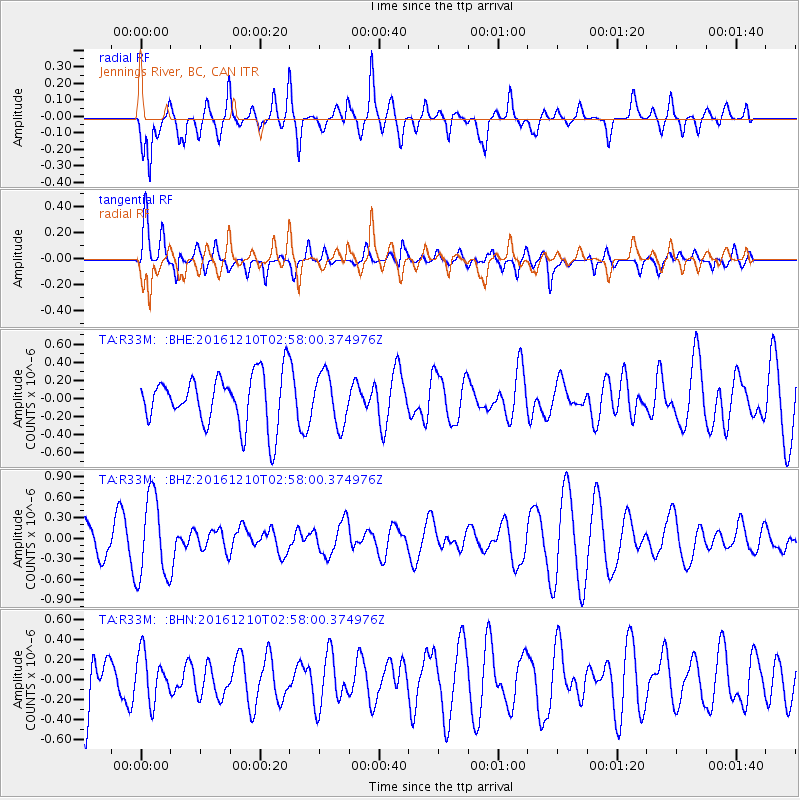
R33M Jennings River, BC, CAN - Earthquake Result Viewer
*The percent match for this event was below the threshold and hence no stack was calculated.
| Earthquake location: |
Solomon Islands |
| Earthquake latitude/longitude: |
-10.9/161.3 |
| Earthquake time(UTC): |
2016/12/10 (345) 02:45:40 GMT |
| Earthquake Depth: |
10 km |
| Earthquake Magnitude: |
5.5 mb |
| Earthquake Catalog/Contributor: |
NEIC PDE/us |
|
| Network: |
TA USArray Transportable Network (new EarthScope stations) |
| Station: |
R33M Jennings River, BC, CAN |
| Lat/Lon: |
59.39 N/130.97 W |
| Elevation: |
1437 m |
|
| Distance: |
88.3 deg |
| Az: |
28.276 deg |
| Baz: |
245.422 deg |
| Ray Param: |
$rayparam |
*The percent match for this event was below the threshold and hence was not used in the summary stack. |
|
| Radial Match: |
59.25311 % |
| Radial Bump: |
400 |
| Transverse Match: |
46.750004 % |
| Transverse Bump: |
400 |
| SOD ConfigId: |
11737051 |
| Insert Time: |
2019-04-26 07:19:33.142 +0000 |
| GWidth: |
2.5 |
| Max Bumps: |
400 |
| Tol: |
0.001 |
|
Signal To Noise
| Channel | StoN | STA | LTA |
| TA:R33M: :BHZ:20161210T02:58:00.374976Z | 2.5072873 | 6.0341887E-7 | 2.4066605E-7 |
| TA:R33M: :BHN:20161210T02:58:00.374976Z | 0.9343567 | 2.3623662E-7 | 2.5283344E-7 |
| TA:R33M: :BHE:20161210T02:58:00.374976Z | 0.985024 | 2.776749E-7 | 2.8189658E-7 |
| Arrivals |
| Ps | |
| PpPs | |
| PsPs/PpSs | |


