You are here: Home > Network List > CI - Caltech Regional Seismic Network Stations List
> Station MPM Manuel Prospect Mine, California, USA > Earthquake Result Viewer
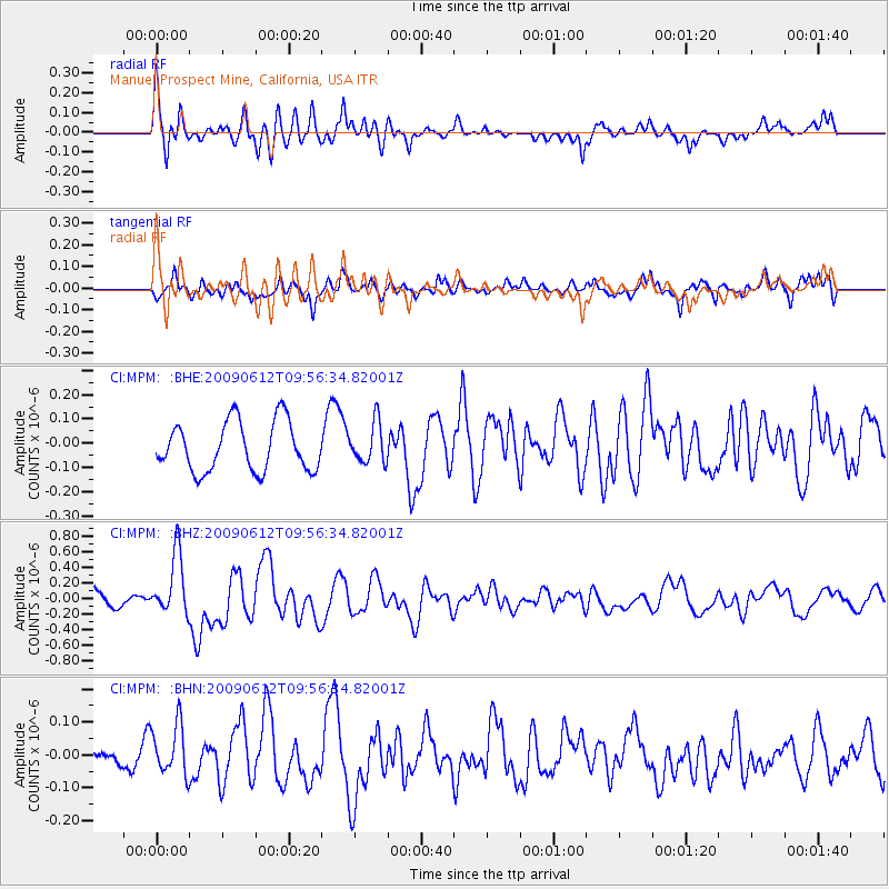
MPM Manuel Prospect Mine, California, USA - Earthquake Result Viewer
*The percent match for this event was below the threshold and hence no stack was calculated.
| Earthquake location: |
Vanuatu Islands |
| Earthquake latitude/longitude: |
-17.6/167.8 |
| Earthquake time(UTC): |
2009/06/12 (163) 09:44:15 GMT |
| Earthquake Depth: |
15 km |
| Earthquake Magnitude: |
5.5 MB, 5.6 MS, 6.0 MW, 6.0 MW |
| Earthquake Catalog/Contributor: |
WHDF/NEIC |
|
| Network: |
CI Caltech Regional Seismic Network |
| Station: |
MPM Manuel Prospect Mine, California, USA |
| Lat/Lon: |
36.06 N/117.49 W |
| Elevation: |
185 m |
|
| Distance: |
88.4 deg |
| Az: |
51.433 deg |
| Baz: |
246.964 deg |
| Ray Param: |
$rayparam |
*The percent match for this event was below the threshold and hence was not used in the summary stack. |
|
| Radial Match: |
74.895164 % |
| Radial Bump: |
400 |
| Transverse Match: |
68.57782 % |
| Transverse Bump: |
400 |
| SOD ConfigId: |
2648 |
| Insert Time: |
2010-03-05 20:29:08.095 +0000 |
| GWidth: |
2.5 |
| Max Bumps: |
400 |
| Tol: |
0.001 |
|
Signal To Noise
| Channel | StoN | STA | LTA |
| CI:MPM: :BHZ:20090612T09:56:34.82001Z | 4.4449186 | 3.9417628E-7 | 8.86802E-8 |
| CI:MPM: :BHN:20090612T09:56:34.82001Z | 1.5345732 | 7.8024456E-8 | 5.0844402E-8 |
| CI:MPM: :BHE:20090612T09:56:34.82001Z | 0.8085435 | 8.1777465E-8 | 1.011417E-7 |
| Arrivals |
| Ps | |
| PpPs | |
| PsPs/PpSs | |


