You are here: Home > Network List > CI - Caltech Regional Seismic Network Stations List
> Station MPM Manuel Prospect Mine, California, USA > Earthquake Result Viewer
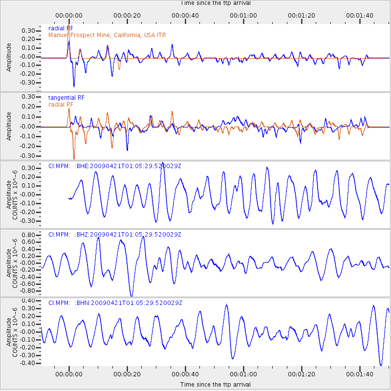
MPM Manuel Prospect Mine, California, USA - Earthquake Result Viewer
*The percent match for this event was below the threshold and hence no stack was calculated.
| Earthquake location: |
Vanuatu Islands |
| Earthquake latitude/longitude: |
-19.8/169.9 |
| Earthquake time(UTC): |
2009/04/21 (111) 00:53:13 GMT |
| Earthquake Depth: |
36 km |
| Earthquake Magnitude: |
5.6 MB, 5.3 MS, 5.8 MW, 5.6 MW |
| Earthquake Catalog/Contributor: |
WHDF/NEIC |
|
| Network: |
CI Caltech Regional Seismic Network |
| Station: |
MPM Manuel Prospect Mine, California, USA |
| Lat/Lon: |
36.06 N/117.49 W |
| Elevation: |
185 m |
|
| Distance: |
88.2 deg |
| Az: |
50.668 deg |
| Baz: |
244.024 deg |
| Ray Param: |
$rayparam |
*The percent match for this event was below the threshold and hence was not used in the summary stack. |
|
| Radial Match: |
62.00758 % |
| Radial Bump: |
400 |
| Transverse Match: |
51.651722 % |
| Transverse Bump: |
400 |
| SOD ConfigId: |
2658 |
| Insert Time: |
2010-03-05 20:29:09.697 +0000 |
| GWidth: |
2.5 |
| Max Bumps: |
400 |
| Tol: |
0.001 |
|
Signal To Noise
| Channel | StoN | STA | LTA |
| CI:MPM: :BHZ:20090421T01:05:29.520029Z | 2.182332 | 2.7610204E-7 | 1.2651698E-7 |
| CI:MPM: :BHN:20090421T01:05:29.520029Z | 1.1071088 | 1.199006E-7 | 1.08300654E-7 |
| CI:MPM: :BHE:20090421T01:05:29.520029Z | 1.8936971 | 2.408059E-7 | 1.2716178E-7 |
| Arrivals |
| Ps | |
| PpPs | |
| PsPs/PpSs | |


