You are here: Home > Network List > CI - Caltech Regional Seismic Network Stations List
> Station MPM Manuel Prospect Mine, California, USA > Earthquake Result Viewer
MPM Manuel Prospect Mine, California, USA - Earthquake Result Viewer
*The percent match for this event was below the threshold and hence no stack was calculated.
| Earthquake location: |
Northwest Of Ryukyu Islands |
| Earthquake latitude/longitude: |
28.5/127.6 |
| Earthquake time(UTC): |
1998/10/03 (276) 11:15:42 GMT |
| Earthquake Depth: |
227 km |
| Earthquake Magnitude: |
5.6 MB, 6.1 UNKNOWN, 6.1 MW |
| Earthquake Catalog/Contributor: |
WHDF/NEIC |
|
| Network: |
CI Caltech Regional Seismic Network |
| Station: |
MPM Manuel Prospect Mine, California, USA |
| Lat/Lon: |
36.06 N/117.49 W |
| Elevation: |
185 m |
|
| Distance: |
91.3 deg |
| Az: |
47.322 deg |
| Baz: |
307.011 deg |
| Ray Param: |
$rayparam |
*The percent match for this event was below the threshold and hence was not used in the summary stack. |
|
| Radial Match: |
55.588795 % |
| Radial Bump: |
400 |
| Transverse Match: |
68.15248 % |
| Transverse Bump: |
400 |
| SOD ConfigId: |
4480 |
| Insert Time: |
2010-03-05 20:29:13.201 +0000 |
| GWidth: |
2.5 |
| Max Bumps: |
400 |
| Tol: |
0.001 |
|
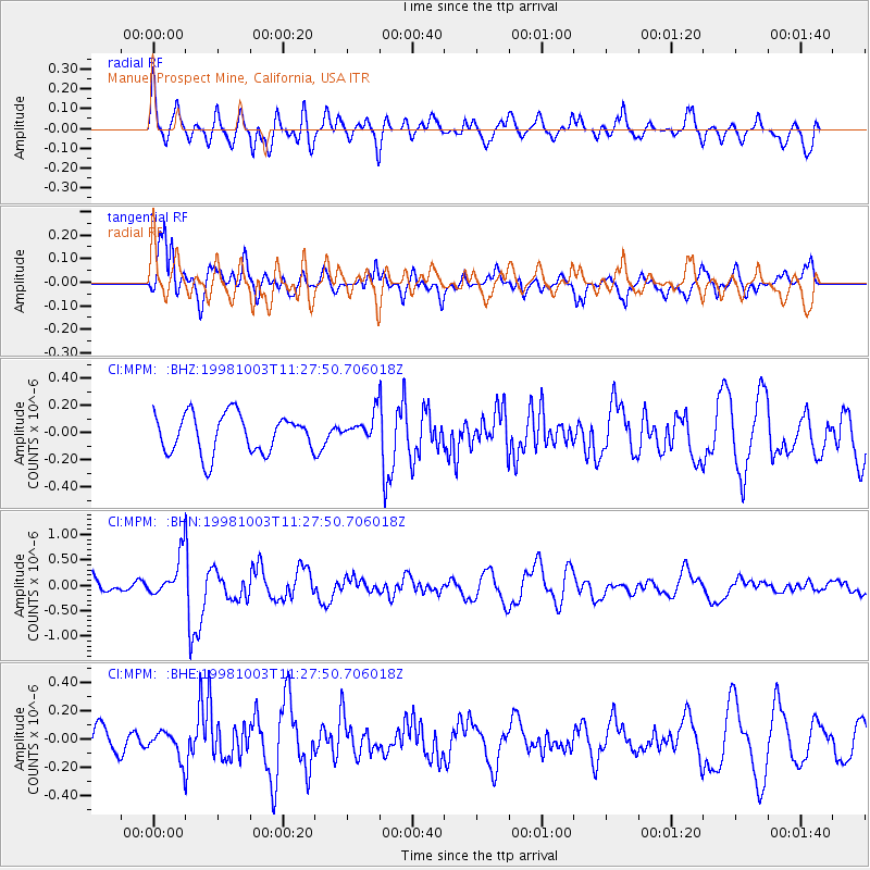
Signal To Noise
| Channel | StoN | STA | LTA |
| CI:MPM: :BHN:19981003T11:27:50.706018Z | 2.4836736 | 4.289767E-7 | 1.7271863E-7 |
| CI:MPM: :BHE:19981003T11:27:50.706018Z | 1.3967679 | 9.9954654E-8 | 7.156139E-8 |
| CI:MPM: :BHZ:19981003T11:27:50.706018Z | 0.6861362 | 9.785757E-8 | 1.426212E-7 |
| Arrivals |
| Ps | |
| PpPs | |
| PsPs/PpSs | |


