You are here: Home > Network List > CI - Caltech Regional Seismic Network Stations List
> Station MPM Manuel Prospect Mine, California, USA > Earthquake Result Viewer
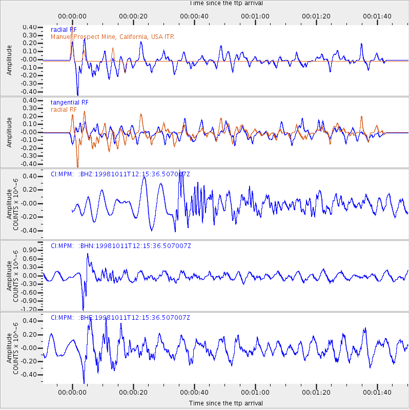
MPM Manuel Prospect Mine, California, USA - Earthquake Result Viewer
*The percent match for this event was below the threshold and hence no stack was calculated.
| Earthquake location: |
Fiji Islands Region |
| Earthquake latitude/longitude: |
-21.0/-179.1 |
| Earthquake time(UTC): |
1998/10/11 (284) 12:04:54 GMT |
| Earthquake Depth: |
624 km |
| Earthquake Magnitude: |
5.9 UNKNOWN, 5.4 MB, 5.9 MW |
| Earthquake Catalog/Contributor: |
WHDF/NEIC |
|
| Network: |
CI Caltech Regional Seismic Network |
| Station: |
MPM Manuel Prospect Mine, California, USA |
| Lat/Lon: |
36.06 N/117.49 W |
| Elevation: |
185 m |
|
| Distance: |
81.3 deg |
| Az: |
46.149 deg |
| Baz: |
236.238 deg |
| Ray Param: |
$rayparam |
*The percent match for this event was below the threshold and hence was not used in the summary stack. |
|
| Radial Match: |
56.75005 % |
| Radial Bump: |
400 |
| Transverse Match: |
75.31797 % |
| Transverse Bump: |
400 |
| SOD ConfigId: |
4480 |
| Insert Time: |
2010-03-05 20:29:17.748 +0000 |
| GWidth: |
2.5 |
| Max Bumps: |
400 |
| Tol: |
0.001 |
|
Signal To Noise
| Channel | StoN | STA | LTA |
| CI:MPM: :BHN:19981011T12:15:36.507007Z | 2.8903892 | 3.6756197E-7 | 1.2716694E-7 |
| CI:MPM: :BHE:19981011T12:15:36.507007Z | 1.9070808 | 1.7631744E-7 | 9.24541E-8 |
| CI:MPM: :BHZ:19981011T12:15:36.507007Z | 1.3419402 | 1.9393636E-7 | 1.4451938E-7 |
| Arrivals |
| Ps | |
| PpPs | |
| PsPs/PpSs | |


