You are here: Home > Network List > CI - Caltech Regional Seismic Network Stations List
> Station MPM Manuel Prospect Mine, California, USA > Earthquake Result Viewer
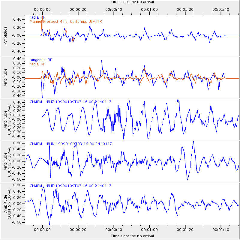
MPM Manuel Prospect Mine, California, USA - Earthquake Result Viewer
*The percent match for this event was below the threshold and hence no stack was calculated.
| Earthquake location: |
Kuril Islands |
| Earthquake latitude/longitude: |
44.4/147.3 |
| Earthquake time(UTC): |
1999/01/09 (009) 03:05:37 GMT |
| Earthquake Depth: |
119 km |
| Earthquake Magnitude: |
5.8 MB, 5.8 MW, 5.6 MW |
| Earthquake Catalog/Contributor: |
WHDF/NEIC |
|
| Network: |
CI Caltech Regional Seismic Network |
| Station: |
MPM Manuel Prospect Mine, California, USA |
| Lat/Lon: |
36.06 N/117.49 W |
| Elevation: |
185 m |
|
| Distance: |
69.2 deg |
| Az: |
59.712 deg |
| Baz: |
310.18 deg |
| Ray Param: |
$rayparam |
*The percent match for this event was below the threshold and hence was not used in the summary stack. |
|
| Radial Match: |
56.36976 % |
| Radial Bump: |
400 |
| Transverse Match: |
63.97209 % |
| Transverse Bump: |
400 |
| SOD ConfigId: |
4480 |
| Insert Time: |
2010-03-05 20:29:24.302 +0000 |
| GWidth: |
2.5 |
| Max Bumps: |
400 |
| Tol: |
0.001 |
|
Signal To Noise
| Channel | StoN | STA | LTA |
| CI:MPM: :BHN:19990109T03:16:00.244011Z | 1.8159653 | 1.8217617E-7 | 1.0031919E-7 |
| CI:MPM: :BHE:19990109T03:16:00.244011Z | 2.6627836 | 4.0047414E-7 | 1.503968E-7 |
| CI:MPM: :BHZ:19990109T03:16:00.244011Z | 1.439124 | 2.5466124E-7 | 1.7695574E-7 |
| Arrivals |
| Ps | |
| PpPs | |
| PsPs/PpSs | |


