You are here: Home > Network List > CI - Caltech Regional Seismic Network Stations List
> Station MPM Manuel Prospect Mine, California, USA > Earthquake Result Viewer
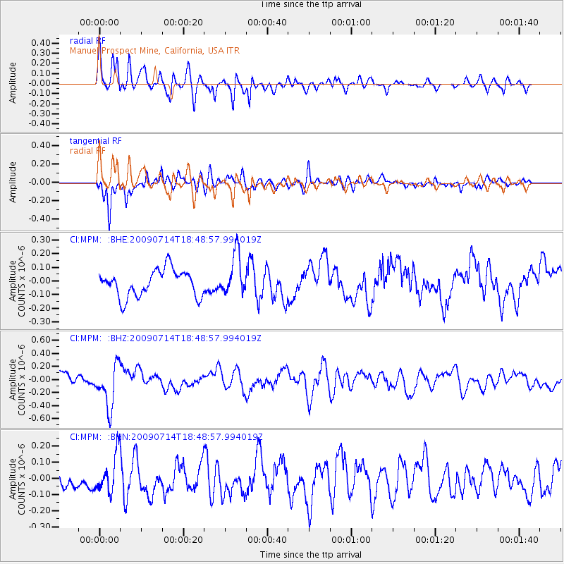
MPM Manuel Prospect Mine, California, USA - Earthquake Result Viewer
*The percent match for this event was below the threshold and hence no stack was calculated.
| Earthquake location: |
Chile-Bolivia Border Region |
| Earthquake latitude/longitude: |
-21.8/-67.1 |
| Earthquake time(UTC): |
2009/07/14 (195) 18:38:08 GMT |
| Earthquake Depth: |
176 km |
| Earthquake Magnitude: |
5.7 MW, 5.4 MB, 5.7 MW |
| Earthquake Catalog/Contributor: |
WHDF/NEIC |
|
| Network: |
CI Caltech Regional Seismic Network |
| Station: |
MPM Manuel Prospect Mine, California, USA |
| Lat/Lon: |
36.06 N/117.49 W |
| Elevation: |
185 m |
|
| Distance: |
74.7 deg |
| Az: |
319.669 deg |
| Baz: |
132.083 deg |
| Ray Param: |
$rayparam |
*The percent match for this event was below the threshold and hence was not used in the summary stack. |
|
| Radial Match: |
75.61328 % |
| Radial Bump: |
400 |
| Transverse Match: |
82.389305 % |
| Transverse Bump: |
400 |
| SOD ConfigId: |
2648 |
| Insert Time: |
2010-03-05 20:29:33.141 +0000 |
| GWidth: |
2.5 |
| Max Bumps: |
400 |
| Tol: |
0.001 |
|
Signal To Noise
| Channel | StoN | STA | LTA |
| CI:MPM: :BHZ:20090714T18:48:57.994019Z | 4.2344284 | 3.4533792E-7 | 8.155479E-8 |
| CI:MPM: :BHN:20090714T18:48:57.994019Z | 2.3449194 | 1.2001813E-7 | 5.1182194E-8 |
| CI:MPM: :BHE:20090714T18:48:57.994019Z | 1.5951875 | 1.5507304E-7 | 9.721305E-8 |
| Arrivals |
| Ps | |
| PpPs | |
| PsPs/PpSs | |


