You are here: Home > Network List > CI - Caltech Regional Seismic Network Stations List
> Station MPM Manuel Prospect Mine, California, USA > Earthquake Result Viewer
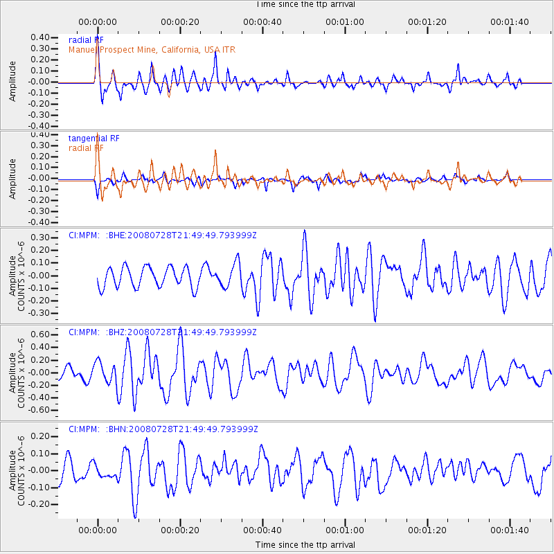
MPM Manuel Prospect Mine, California, USA - Earthquake Result Viewer
*The percent match for this event was below the threshold and hence no stack was calculated.
| Earthquake location: |
Solomon Islands |
| Earthquake latitude/longitude: |
-10.6/163.2 |
| Earthquake time(UTC): |
2008/07/28 (210) 21:37:32 GMT |
| Earthquake Depth: |
10 km |
| Earthquake Magnitude: |
5.7 MB, 6.1 MS, 5.9 MW |
| Earthquake Catalog/Contributor: |
WHDF/NEIC |
|
| Network: |
CI Caltech Regional Seismic Network |
| Station: |
MPM Manuel Prospect Mine, California, USA |
| Lat/Lon: |
36.06 N/117.49 W |
| Elevation: |
185 m |
|
| Distance: |
87.7 deg |
| Az: |
52.842 deg |
| Baz: |
255.234 deg |
| Ray Param: |
$rayparam |
*The percent match for this event was below the threshold and hence was not used in the summary stack. |
|
| Radial Match: |
72.66235 % |
| Radial Bump: |
400 |
| Transverse Match: |
63.770855 % |
| Transverse Bump: |
294 |
| SOD ConfigId: |
2658 |
| Insert Time: |
2010-03-05 20:29:52.641 +0000 |
| GWidth: |
2.5 |
| Max Bumps: |
400 |
| Tol: |
0.001 |
|
Signal To Noise
| Channel | StoN | STA | LTA |
| CI:MPM: :BHZ:20080728T21:49:49.793999Z | 2.8105216 | 1.7116203E-7 | 6.090045E-8 |
| CI:MPM: :BHN:20080728T21:49:49.793999Z | 0.7486162 | 3.2408202E-8 | 4.329081E-8 |
| CI:MPM: :BHE:20080728T21:49:49.793999Z | 1.2270476 | 9.482206E-8 | 7.7276596E-8 |
| Arrivals |
| Ps | |
| PpPs | |
| PsPs/PpSs | |


