You are here: Home > Network List > CI - Caltech Regional Seismic Network Stations List
> Station MPP McPhearson Peak > Earthquake Result Viewer
MPP McPhearson Peak - Earthquake Result Viewer
*The percent match for this event was below the threshold and hence no stack was calculated.
| Earthquake location: |
Solomon Islands |
| Earthquake latitude/longitude: |
-5.7/154.5 |
| Earthquake time(UTC): |
2016/12/10 (345) 16:24:36 GMT |
| Earthquake Depth: |
157 km |
| Earthquake Magnitude: |
6.1 Mwp |
| Earthquake Catalog/Contributor: |
NEIC PDE/us |
|
| Network: |
CI Caltech Regional Seismic Network |
| Station: |
MPP McPhearson Peak |
| Lat/Lon: |
34.89 N/119.81 W |
| Elevation: |
1739 m |
|
| Distance: |
89.7 deg |
| Az: |
55.061 deg |
| Baz: |
262.932 deg |
| Ray Param: |
$rayparam |
*The percent match for this event was below the threshold and hence was not used in the summary stack. |
|
| Radial Match: |
71.32131 % |
| Radial Bump: |
400 |
| Transverse Match: |
67.85368 % |
| Transverse Bump: |
400 |
| SOD ConfigId: |
11737051 |
| Insert Time: |
2019-04-26 07:25:26.302 +0000 |
| GWidth: |
2.5 |
| Max Bumps: |
400 |
| Tol: |
0.001 |
|
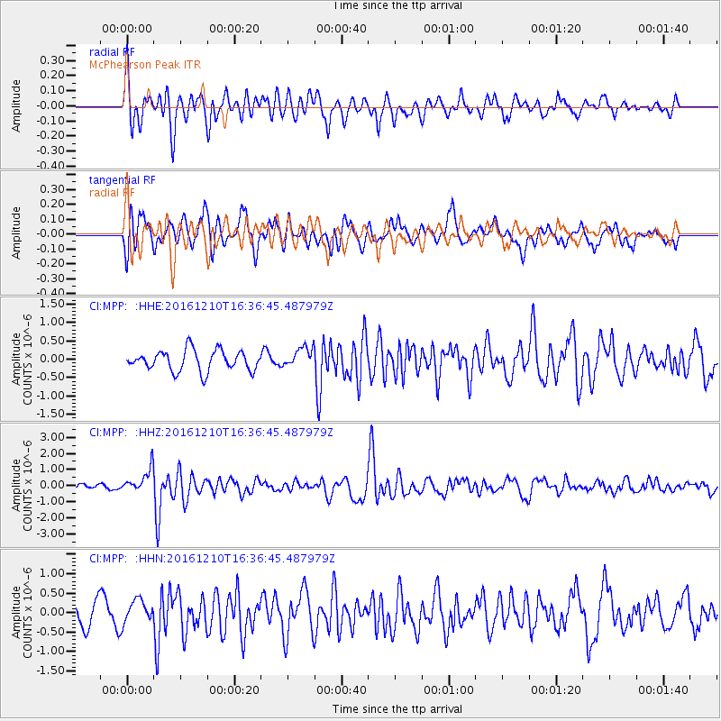
Signal To Noise
| Channel | StoN | STA | LTA |
| CI:MPP: :HHZ:20161210T16:36:45.487979Z | 3.7221575 | 7.479908E-7 | 2.0095624E-7 |
| CI:MPP: :HHN:20161210T16:36:45.487979Z | 1.3151829 | 2.9366052E-7 | 2.2328491E-7 |
| CI:MPP: :HHE:20161210T16:36:45.487979Z | 0.99287087 | 2.7706284E-7 | 2.7905224E-7 |
| Arrivals |
| Ps | |
| PpPs | |
| PsPs/PpSs | |


