You are here: Home > Network List > CI - Caltech Regional Seismic Network Stations List
> Station MPM Manuel Prospect Mine, California, USA > Earthquake Result Viewer
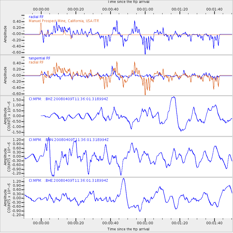
MPM Manuel Prospect Mine, California, USA - Earthquake Result Viewer
*The percent match for this event was below the threshold and hence no stack was calculated.
| Earthquake location: |
Loyalty Islands |
| Earthquake latitude/longitude: |
-20.2/168.9 |
| Earthquake time(UTC): |
2008/04/09 (100) 11:23:40 GMT |
| Earthquake Depth: |
35 km |
| Earthquake Magnitude: |
5.7 MB, 6.3 MW, 6.3 MW |
| Earthquake Catalog/Contributor: |
WHDF/NEIC |
|
| Network: |
CI Caltech Regional Seismic Network |
| Station: |
MPM Manuel Prospect Mine, California, USA |
| Lat/Lon: |
36.06 N/117.49 W |
| Elevation: |
185 m |
|
| Distance: |
89.2 deg |
| Az: |
51.026 deg |
| Baz: |
244.32 deg |
| Ray Param: |
$rayparam |
*The percent match for this event was below the threshold and hence was not used in the summary stack. |
|
| Radial Match: |
71.43415 % |
| Radial Bump: |
382 |
| Transverse Match: |
66.08338 % |
| Transverse Bump: |
400 |
| SOD ConfigId: |
2504 |
| Insert Time: |
2010-03-05 20:29:54.833 +0000 |
| GWidth: |
2.5 |
| Max Bumps: |
400 |
| Tol: |
0.001 |
|
Signal To Noise
| Channel | StoN | STA | LTA |
| CI:MPM: :BHN:20080409T11:36:01.318994Z | 3.1086593 | 6.8534007E-7 | 2.2046163E-7 |
| CI:MPM: :BHE:20080409T11:36:01.318994Z | 0.68074733 | 1.4102964E-7 | 2.0716885E-7 |
| CI:MPM: :BHZ:20080409T11:36:01.318994Z | 2.303538 | 3.7633873E-7 | 1.6337422E-7 |
| Arrivals |
| Ps | |
| PpPs | |
| PsPs/PpSs | |


