You are here: Home > Network List > CI - Caltech Regional Seismic Network Stations List
> Station SMM Simmler, CA, USA > Earthquake Result Viewer
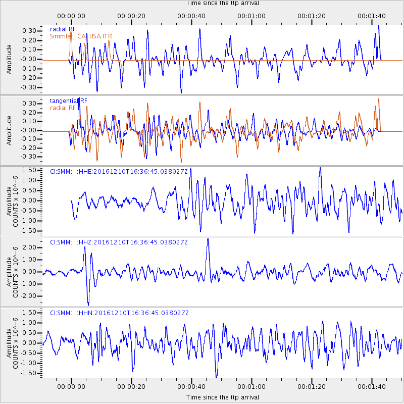
SMM Simmler, CA, USA - Earthquake Result Viewer
*The percent match for this event was below the threshold and hence no stack was calculated.
| Earthquake location: |
Solomon Islands |
| Earthquake latitude/longitude: |
-5.7/154.5 |
| Earthquake time(UTC): |
2016/12/10 (345) 16:24:36 GMT |
| Earthquake Depth: |
157 km |
| Earthquake Magnitude: |
6.1 Mwp |
| Earthquake Catalog/Contributor: |
NEIC PDE/us |
|
| Network: |
CI Caltech Regional Seismic Network |
| Station: |
SMM Simmler, CA, USA |
| Lat/Lon: |
35.31 N/120.00 W |
| Elevation: |
599 m |
|
| Distance: |
89.6 deg |
| Az: |
54.621 deg |
| Baz: |
262.825 deg |
| Ray Param: |
$rayparam |
*The percent match for this event was below the threshold and hence was not used in the summary stack. |
|
| Radial Match: |
65.56289 % |
| Radial Bump: |
400 |
| Transverse Match: |
58.30922 % |
| Transverse Bump: |
400 |
| SOD ConfigId: |
11737051 |
| Insert Time: |
2019-04-26 07:25:37.796 +0000 |
| GWidth: |
2.5 |
| Max Bumps: |
400 |
| Tol: |
0.001 |
|
Signal To Noise
| Channel | StoN | STA | LTA |
| CI:SMM: :HHZ:20161210T16:36:45.038027Z | 4.227378 | 6.756207E-7 | 1.5982027E-7 |
| CI:SMM: :HHN:20161210T16:36:45.038027Z | 1.0172024 | 3.5811968E-7 | 3.5206335E-7 |
| CI:SMM: :HHE:20161210T16:36:45.038027Z | 1.6517549 | 4.243035E-7 | 2.568804E-7 |
| Arrivals |
| Ps | |
| PpPs | |
| PsPs/PpSs | |


