You are here: Home > Network List > CN - Canadian National Seismograph Network Stations List
> Station INK INUVIK, NT > Earthquake Result Viewer
INK INUVIK, NT - Earthquake Result Viewer
*The percent match for this event was below the threshold and hence no stack was calculated.
| Earthquake location: |
Solomon Islands |
| Earthquake latitude/longitude: |
-5.7/154.5 |
| Earthquake time(UTC): |
2016/12/10 (345) 16:24:36 GMT |
| Earthquake Depth: |
157 km |
| Earthquake Magnitude: |
6.1 Mwp |
| Earthquake Catalog/Contributor: |
NEIC PDE/us |
|
| Network: |
CN Canadian National Seismograph Network |
| Station: |
INK INUVIK, NT |
| Lat/Lon: |
68.31 N/133.53 W |
| Elevation: |
44 m |
|
| Distance: |
88.7 deg |
| Az: |
20.712 deg |
| Baz: |
251.204 deg |
| Ray Param: |
$rayparam |
*The percent match for this event was below the threshold and hence was not used in the summary stack. |
|
| Radial Match: |
50.67342 % |
| Radial Bump: |
400 |
| Transverse Match: |
49.979874 % |
| Transverse Bump: |
400 |
| SOD ConfigId: |
11737051 |
| Insert Time: |
2019-04-26 07:25:57.178 +0000 |
| GWidth: |
2.5 |
| Max Bumps: |
400 |
| Tol: |
0.001 |
|
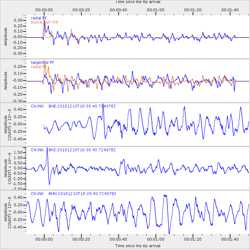
Signal To Noise
| Channel | StoN | STA | LTA |
| CN:INK: :BHZ:20161210T16:36:40.724978Z | 4.771015 | 8.2844673E-7 | 1.736416E-7 |
| CN:INK: :BHN:20161210T16:36:40.724978Z | 1.5672864 | 2.2446025E-7 | 1.4321586E-7 |
| CN:INK: :BHE:20161210T16:36:40.724978Z | 2.7593496 | 2.677068E-7 | 9.7018074E-8 |
| Arrivals |
| Ps | |
| PpPs | |
| PsPs/PpSs | |


