You are here: Home > Network List > CI - Caltech Regional Seismic Network Stations List
> Station MPM Manuel Prospect Mine, California, USA > Earthquake Result Viewer
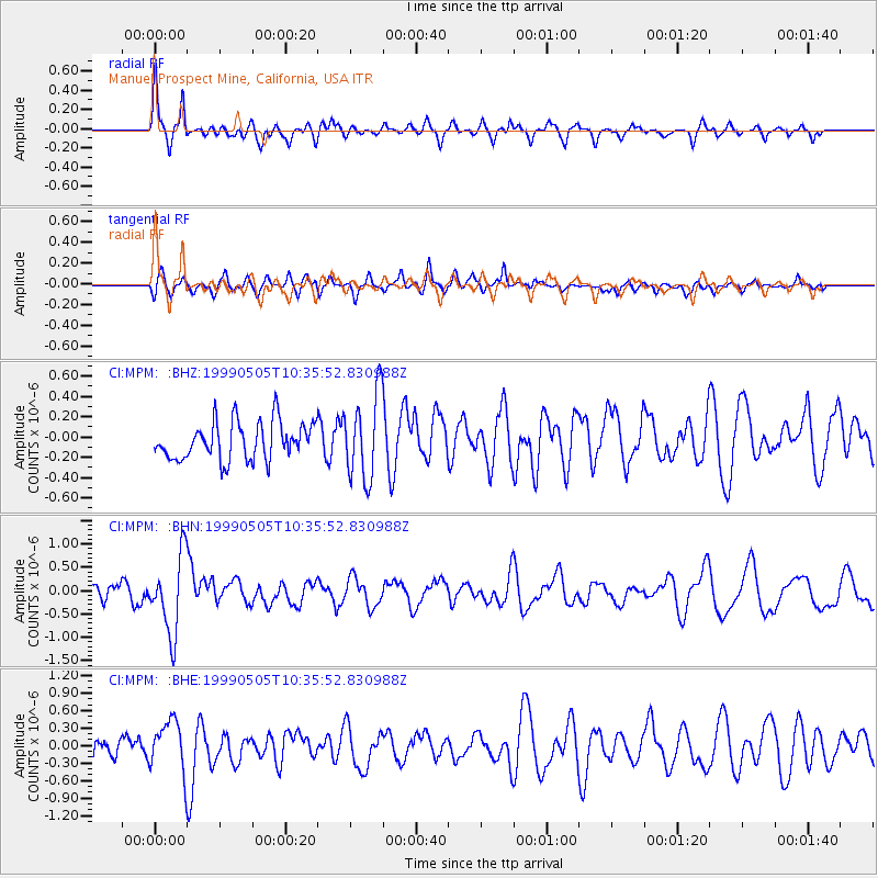
MPM Manuel Prospect Mine, California, USA - Earthquake Result Viewer
*The percent match for this event was below the threshold and hence no stack was calculated.
| Earthquake location: |
Kenai Peninsula, Alaska |
| Earthquake latitude/longitude: |
59.3/-151.5 |
| Earthquake time(UTC): |
1999/05/05 (125) 10:30:03 GMT |
| Earthquake Depth: |
71 km |
| Earthquake Magnitude: |
5.4 MB, 5.8 MW, 5.8 MW |
| Earthquake Catalog/Contributor: |
WHDF/NEIC |
|
| Network: |
CI Caltech Regional Seismic Network |
| Station: |
MPM Manuel Prospect Mine, California, USA |
| Lat/Lon: |
36.06 N/117.49 W |
| Elevation: |
185 m |
|
| Distance: |
32.1 deg |
| Az: |
121.284 deg |
| Baz: |
327.229 deg |
| Ray Param: |
$rayparam |
*The percent match for this event was below the threshold and hence was not used in the summary stack. |
|
| Radial Match: |
78.98848 % |
| Radial Bump: |
355 |
| Transverse Match: |
70.0845 % |
| Transverse Bump: |
400 |
| SOD ConfigId: |
4480 |
| Insert Time: |
2010-03-05 20:30:03.206 +0000 |
| GWidth: |
2.5 |
| Max Bumps: |
400 |
| Tol: |
0.001 |
|
Signal To Noise
| Channel | StoN | STA | LTA |
| CI:MPM: :BHN:19990505T10:35:52.830988Z | 2.3634973 | 8.2918064E-7 | 3.5082783E-7 |
| CI:MPM: :BHE:19990505T10:35:52.830988Z | 1.7105278 | 4.3794495E-7 | 2.5602915E-7 |
| CI:MPM: :BHZ:19990505T10:35:52.830988Z | 2.3023105 | 4.2404412E-7 | 1.8418199E-7 |
| Arrivals |
| Ps | |
| PpPs | |
| PsPs/PpSs | |


