You are here: Home > Network List > CI - Caltech Regional Seismic Network Stations List
> Station MPM Manuel Prospect Mine, California, USA > Earthquake Result Viewer
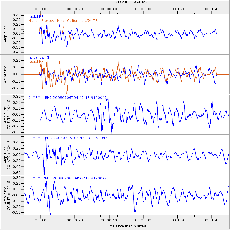
MPM Manuel Prospect Mine, California, USA - Earthquake Result Viewer
*The percent match for this event was below the threshold and hence no stack was calculated.
| Earthquake location: |
South Of Fiji Islands |
| Earthquake latitude/longitude: |
-25.5/-176.4 |
| Earthquake time(UTC): |
2008/07/06 (188) 04:30:26 GMT |
| Earthquake Depth: |
49 km |
| Earthquake Magnitude: |
5.5 MB, 5.3 MS |
| Earthquake Catalog/Contributor: |
WHDF/NEIC |
|
| Network: |
CI Caltech Regional Seismic Network |
| Station: |
MPM Manuel Prospect Mine, California, USA |
| Lat/Lon: |
36.06 N/117.49 W |
| Elevation: |
185 m |
|
| Distance: |
82.6 deg |
| Az: |
44.373 deg |
| Baz: |
231.279 deg |
| Ray Param: |
$rayparam |
*The percent match for this event was below the threshold and hence was not used in the summary stack. |
|
| Radial Match: |
53.911736 % |
| Radial Bump: |
400 |
| Transverse Match: |
52.89787 % |
| Transverse Bump: |
400 |
| SOD ConfigId: |
2504 |
| Insert Time: |
2010-03-05 20:30:15.676 +0000 |
| GWidth: |
2.5 |
| Max Bumps: |
400 |
| Tol: |
0.001 |
|
Signal To Noise
| Channel | StoN | STA | LTA |
| CI:MPM: :BHN:20080706T04:42:13.919004Z | 4.046783 | 2.5827438E-7 | 6.382215E-8 |
| CI:MPM: :BHE:20080706T04:42:13.919004Z | 1.9423568 | 1.1159226E-7 | 5.7451985E-8 |
| CI:MPM: :BHZ:20080706T04:42:13.919004Z | 1.2747917 | 1.00801316E-7 | 7.907277E-8 |
| Arrivals |
| Ps | |
| PpPs | |
| PsPs/PpSs | |


