You are here: Home > Network List > CI - Caltech Regional Seismic Network Stations List
> Station MPM Manuel Prospect Mine, California, USA > Earthquake Result Viewer
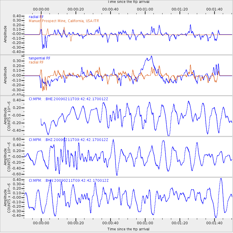
MPM Manuel Prospect Mine, California, USA - Earthquake Result Viewer
*The percent match for this event was below the threshold and hence no stack was calculated.
| Earthquake location: |
Fiji Islands Region |
| Earthquake latitude/longitude: |
-20.8/-177.3 |
| Earthquake time(UTC): |
2009/02/11 (042) 09:31:04 GMT |
| Earthquake Depth: |
10 km |
| Earthquake Magnitude: |
5.5 MB, 5.2 MS, 5.5 MW, 5.5 MW |
| Earthquake Catalog/Contributor: |
WHDF/NEIC |
|
| Network: |
CI Caltech Regional Seismic Network |
| Station: |
MPM Manuel Prospect Mine, California, USA |
| Lat/Lon: |
36.06 N/117.49 W |
| Elevation: |
185 m |
|
| Distance: |
79.9 deg |
| Az: |
45.342 deg |
| Baz: |
235.231 deg |
| Ray Param: |
$rayparam |
*The percent match for this event was below the threshold and hence was not used in the summary stack. |
|
| Radial Match: |
65.62045 % |
| Radial Bump: |
400 |
| Transverse Match: |
28.816486 % |
| Transverse Bump: |
400 |
| SOD ConfigId: |
2658 |
| Insert Time: |
2010-03-05 20:30:18.610 +0000 |
| GWidth: |
2.5 |
| Max Bumps: |
400 |
| Tol: |
0.001 |
|
Signal To Noise
| Channel | StoN | STA | LTA |
| CI:MPM: :BHZ:20090211T09:42:42.170012Z | 1.0952499 | 2.3470162E-7 | 2.1429048E-7 |
| CI:MPM: :BHN:20090211T09:42:42.170012Z | 1.099069 | 3.047991E-7 | 2.7732483E-7 |
| CI:MPM: :BHE:20090211T09:42:42.170012Z | 1.080535 | 2.0191001E-7 | 1.8686114E-7 |
| Arrivals |
| Ps | |
| PpPs | |
| PsPs/PpSs | |


