You are here: Home > Network List > CI - Caltech Regional Seismic Network Stations List
> Station MPM Manuel Prospect Mine, California, USA > Earthquake Result Viewer
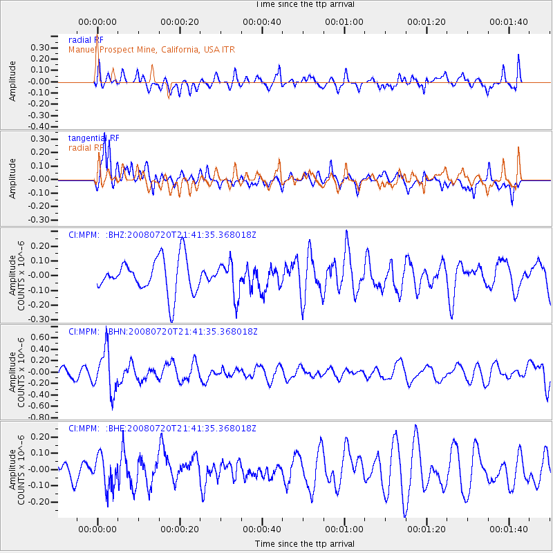
MPM Manuel Prospect Mine, California, USA - Earthquake Result Viewer
*The percent match for this event was below the threshold and hence no stack was calculated.
| Earthquake location: |
Bonin Islands, Japan Region |
| Earthquake latitude/longitude: |
27.8/139.6 |
| Earthquake time(UTC): |
2008/07/20 (202) 21:30:29 GMT |
| Earthquake Depth: |
481 km |
| Earthquake Magnitude: |
5.8 MW, 5.1 MB, 5.8 MW |
| Earthquake Catalog/Contributor: |
WHDF/NEIC |
|
| Network: |
CI Caltech Regional Seismic Network |
| Station: |
MPM Manuel Prospect Mine, California, USA |
| Lat/Lon: |
36.06 N/117.49 W |
| Elevation: |
185 m |
|
| Distance: |
83.6 deg |
| Az: |
52.637 deg |
| Baz: |
299.641 deg |
| Ray Param: |
$rayparam |
*The percent match for this event was below the threshold and hence was not used in the summary stack. |
|
| Radial Match: |
49.983803 % |
| Radial Bump: |
400 |
| Transverse Match: |
56.53691 % |
| Transverse Bump: |
385 |
| SOD ConfigId: |
2504 |
| Insert Time: |
2010-03-05 20:30:24.783 +0000 |
| GWidth: |
2.5 |
| Max Bumps: |
400 |
| Tol: |
0.001 |
|
Signal To Noise
| Channel | StoN | STA | LTA |
| CI:MPM: :BHN:20080720T21:41:35.368018Z | 3.9671082 | 3.7317207E-7 | 9.406652E-8 |
| CI:MPM: :BHE:20080720T21:41:35.368018Z | 1.1761543 | 9.967631E-8 | 8.4747654E-8 |
| CI:MPM: :BHZ:20080720T21:41:35.368018Z | 1.0099012 | 1.18679694E-7 | 1.1751615E-7 |
| Arrivals |
| Ps | |
| PpPs | |
| PsPs/PpSs | |


