You are here: Home > Network List > US - United States National Seismic Network Stations List
> Station MIAR Mount Ida, Arkansas, USA > Earthquake Result Viewer
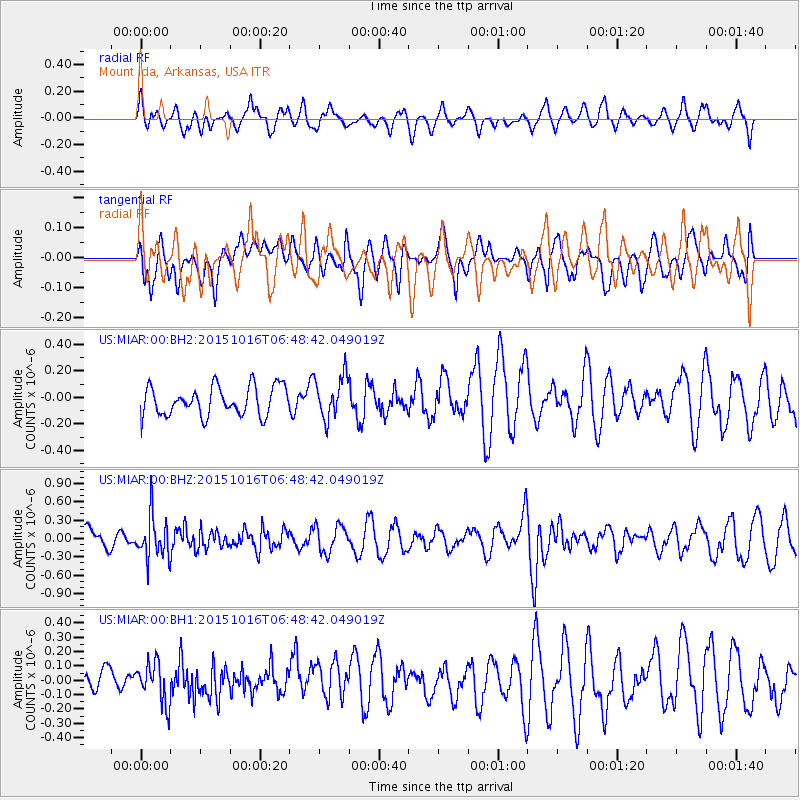
MIAR Mount Ida, Arkansas, USA - Earthquake Result Viewer
*The percent match for this event was below the threshold and hence no stack was calculated.
| Earthquake location: |
Kamchatka Peninsula, Russia |
| Earthquake latitude/longitude: |
55.6/159.2 |
| Earthquake time(UTC): |
2015/10/16 (289) 06:38:26 GMT |
| Earthquake Depth: |
285 km |
| Earthquake Magnitude: |
5.6 MWW, 5.7 MWB |
| Earthquake Catalog/Contributor: |
NEIC PDE/NEIC COMCAT |
|
| Network: |
US United States National Seismic Network |
| Station: |
MIAR Mount Ida, Arkansas, USA |
| Lat/Lon: |
34.55 N/93.58 W |
| Elevation: |
207 m |
|
| Distance: |
71.0 deg |
| Az: |
56.52 deg |
| Baz: |
325.003 deg |
| Ray Param: |
$rayparam |
*The percent match for this event was below the threshold and hence was not used in the summary stack. |
|
| Radial Match: |
49.53329 % |
| Radial Bump: |
400 |
| Transverse Match: |
50.77445 % |
| Transverse Bump: |
400 |
| SOD ConfigId: |
1259291 |
| Insert Time: |
2015-11-06 15:30:28.372 +0000 |
| GWidth: |
2.5 |
| Max Bumps: |
400 |
| Tol: |
0.001 |
|
Signal To Noise
| Channel | StoN | STA | LTA |
| US:MIAR:00:BHZ:20151016T06:48:42.049019Z | 1.4957199 | 3.4420194E-7 | 2.3012458E-7 |
| US:MIAR:00:BH1:20151016T06:48:42.049019Z | 1.31185 | 1.4245413E-7 | 1.08590264E-7 |
| US:MIAR:00:BH2:20151016T06:48:42.049019Z | 1.4499905 | 1.5797872E-7 | 1.08951554E-7 |
| Arrivals |
| Ps | |
| PpPs | |
| PsPs/PpSs | |


