You are here: Home > Network List > TA - USArray Transportable Network (new EarthScope stations) Stations List
> Station G21K Allakaket, AK, USA > Earthquake Result Viewer
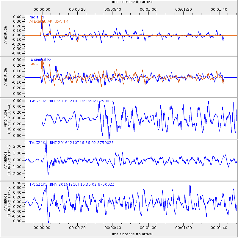
G21K Allakaket, AK, USA - Earthquake Result Viewer
*The percent match for this event was below the threshold and hence no stack was calculated.
| Earthquake location: |
Solomon Islands |
| Earthquake latitude/longitude: |
-5.7/154.5 |
| Earthquake time(UTC): |
2016/12/10 (345) 16:24:36 GMT |
| Earthquake Depth: |
157 km |
| Earthquake Magnitude: |
6.1 Mwp |
| Earthquake Catalog/Contributor: |
NEIC PDE/us |
|
| Network: |
TA USArray Transportable Network (new EarthScope stations) |
| Station: |
G21K Allakaket, AK, USA |
| Lat/Lon: |
66.52 N/153.51 W |
| Elevation: |
446 m |
|
| Distance: |
81.0 deg |
| Az: |
18.646 deg |
| Baz: |
232.558 deg |
| Ray Param: |
$rayparam |
*The percent match for this event was below the threshold and hence was not used in the summary stack. |
|
| Radial Match: |
66.04491 % |
| Radial Bump: |
370 |
| Transverse Match: |
68.24255 % |
| Transverse Bump: |
400 |
| SOD ConfigId: |
11737051 |
| Insert Time: |
2019-04-26 07:29:00.054 +0000 |
| GWidth: |
2.5 |
| Max Bumps: |
400 |
| Tol: |
0.001 |
|
Signal To Noise
| Channel | StoN | STA | LTA |
| TA:G21K: :BHZ:20161210T16:36:02.875002Z | 11.301279 | 1.1637059E-6 | 1.0297116E-7 |
| TA:G21K: :BHN:20161210T16:36:02.875002Z | 4.8183155 | 4.5706528E-7 | 9.485997E-8 |
| TA:G21K: :BHE:20161210T16:36:02.875002Z | 2.2461574 | 2.833768E-7 | 1.2616071E-7 |
| Arrivals |
| Ps | |
| PpPs | |
| PsPs/PpSs | |


