You are here: Home > Network List > TA - USArray Transportable Network (new EarthScope stations) Stations List
> Station O18K Koktuh Hills, AK, USA > Earthquake Result Viewer
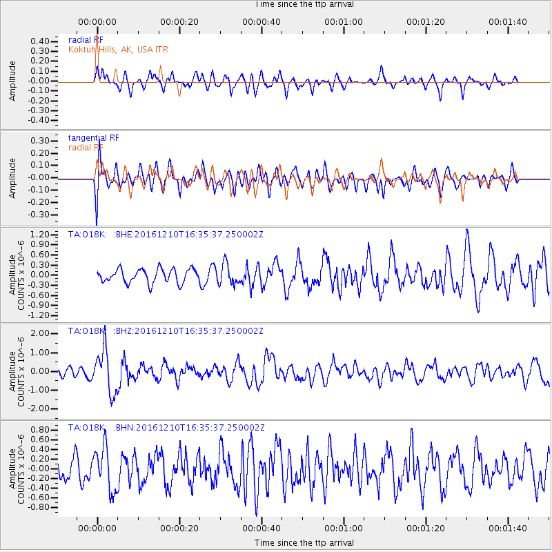
O18K Koktuh Hills, AK, USA - Earthquake Result Viewer
*The percent match for this event was below the threshold and hence no stack was calculated.
| Earthquake location: |
Solomon Islands |
| Earthquake latitude/longitude: |
-5.7/154.5 |
| Earthquake time(UTC): |
2016/12/10 (345) 16:24:36 GMT |
| Earthquake Depth: |
157 km |
| Earthquake Magnitude: |
6.1 Mwp |
| Earthquake Catalog/Contributor: |
NEIC PDE/us |
|
| Network: |
TA USArray Transportable Network (new EarthScope stations) |
| Station: |
O18K Koktuh Hills, AK, USA |
| Lat/Lon: |
59.85 N/155.21 W |
| Elevation: |
544 m |
|
| Distance: |
76.3 deg |
| Az: |
23.558 deg |
| Baz: |
232.004 deg |
| Ray Param: |
$rayparam |
*The percent match for this event was below the threshold and hence was not used in the summary stack. |
|
| Radial Match: |
52.64849 % |
| Radial Bump: |
371 |
| Transverse Match: |
52.69372 % |
| Transverse Bump: |
400 |
| SOD ConfigId: |
11737051 |
| Insert Time: |
2019-04-26 07:29:38.011 +0000 |
| GWidth: |
2.5 |
| Max Bumps: |
400 |
| Tol: |
0.001 |
|
Signal To Noise
| Channel | StoN | STA | LTA |
| TA:O18K: :BHZ:20161210T16:35:37.250002Z | 3.6732378 | 1.1719928E-6 | 3.190626E-7 |
| TA:O18K: :BHN:20161210T16:35:37.250002Z | 2.147693 | 4.5608874E-7 | 2.1236217E-7 |
| TA:O18K: :BHE:20161210T16:35:37.250002Z | 1.4807068 | 3.0325108E-7 | 2.0480157E-7 |
| Arrivals |
| Ps | |
| PpPs | |
| PsPs/PpSs | |


