You are here: Home > Network List > TA - USArray Transportable Network (new EarthScope stations) Stations List
> Station V35K Ketchikan, AK, USA > Earthquake Result Viewer
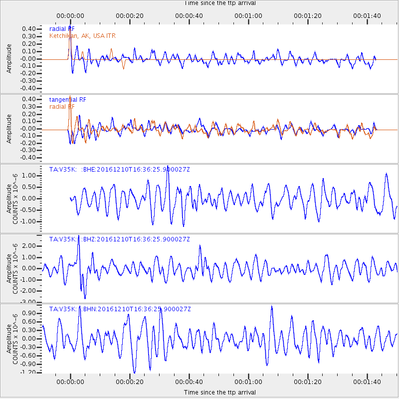
V35K Ketchikan, AK, USA - Earthquake Result Viewer
*The percent match for this event was below the threshold and hence no stack was calculated.
| Earthquake location: |
Solomon Islands |
| Earthquake latitude/longitude: |
-5.7/154.5 |
| Earthquake time(UTC): |
2016/12/10 (345) 16:24:36 GMT |
| Earthquake Depth: |
157 km |
| Earthquake Magnitude: |
6.1 Mwp |
| Earthquake Catalog/Contributor: |
NEIC PDE/us |
|
| Network: |
TA USArray Transportable Network (new EarthScope stations) |
| Station: |
V35K Ketchikan, AK, USA |
| Lat/Lon: |
55.33 N/131.62 W |
| Elevation: |
64 m |
|
| Distance: |
85.6 deg |
| Az: |
33.414 deg |
| Baz: |
253.539 deg |
| Ray Param: |
$rayparam |
*The percent match for this event was below the threshold and hence was not used in the summary stack. |
|
| Radial Match: |
64.412476 % |
| Radial Bump: |
400 |
| Transverse Match: |
60.33694 % |
| Transverse Bump: |
400 |
| SOD ConfigId: |
11737051 |
| Insert Time: |
2019-04-26 07:30:03.747 +0000 |
| GWidth: |
2.5 |
| Max Bumps: |
400 |
| Tol: |
0.001 |
|
Signal To Noise
| Channel | StoN | STA | LTA |
| TA:V35K: :BHZ:20161210T16:36:25.900027Z | 2.3681357 | 1.2448106E-6 | 5.2565E-7 |
| TA:V35K: :BHN:20161210T16:36:25.900027Z | 1.3234882 | 4.734765E-7 | 3.5774892E-7 |
| TA:V35K: :BHE:20161210T16:36:25.900027Z | 1.9531556 | 7.0606563E-7 | 3.6149996E-7 |
| Arrivals |
| Ps | |
| PpPs | |
| PsPs/PpSs | |


