You are here: Home > Network List > UW - Pacific Northwest Regional Seismic Network Stations List
> Station MRBL Marblemount, WA, USA > Earthquake Result Viewer
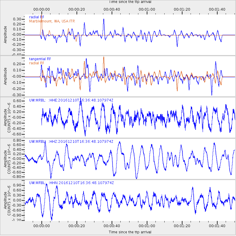
MRBL Marblemount, WA, USA - Earthquake Result Viewer
*The percent match for this event was below the threshold and hence no stack was calculated.
| Earthquake location: |
Solomon Islands |
| Earthquake latitude/longitude: |
-5.7/154.5 |
| Earthquake time(UTC): |
2016/12/10 (345) 16:24:36 GMT |
| Earthquake Depth: |
157 km |
| Earthquake Magnitude: |
6.1 Mwp |
| Earthquake Catalog/Contributor: |
NEIC PDE/us |
|
| Network: |
UW Pacific Northwest Regional Seismic Network |
| Station: |
MRBL Marblemount, WA, USA |
| Lat/Lon: |
48.52 N/121.48 W |
| Elevation: |
75 m |
|
| Distance: |
90.2 deg |
| Az: |
41.397 deg |
| Baz: |
261.808 deg |
| Ray Param: |
$rayparam |
*The percent match for this event was below the threshold and hence was not used in the summary stack. |
|
| Radial Match: |
59.55654 % |
| Radial Bump: |
400 |
| Transverse Match: |
58.136803 % |
| Transverse Bump: |
400 |
| SOD ConfigId: |
11737051 |
| Insert Time: |
2019-04-26 07:30:39.305 +0000 |
| GWidth: |
2.5 |
| Max Bumps: |
400 |
| Tol: |
0.001 |
|
Signal To Noise
| Channel | StoN | STA | LTA |
| UW:MRBL: :HHZ:20161210T16:36:48.107974Z | 0.7298671 | 3.198682E-7 | 4.382554E-7 |
| UW:MRBL: :HHN:20161210T16:36:48.107974Z | 2.3829756 | 6.2470497E-7 | 2.621533E-7 |
| UW:MRBL: :HHE:20161210T16:36:48.107974Z | 1.2492621 | 3.0191387E-7 | 2.4167375E-7 |
| Arrivals |
| Ps | |
| PpPs | |
| PsPs/PpSs | |


