You are here: Home > Network List > TA - USArray Transportable Network (new EarthScope stations) Stations List
> Station P17K Kvichak River, AK, USA > Earthquake Result Viewer
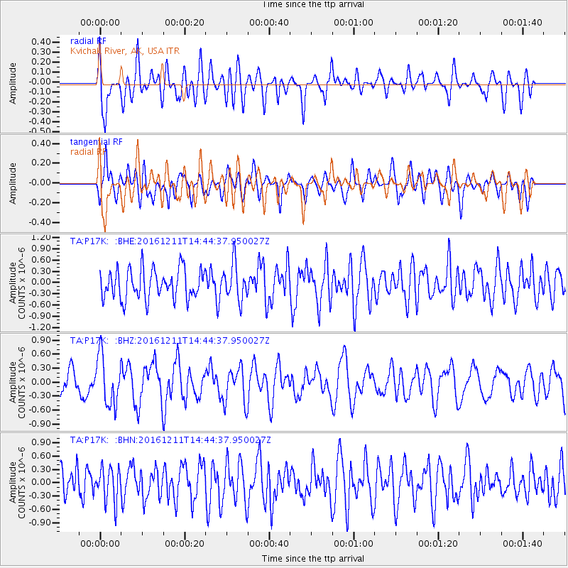
P17K Kvichak River, AK, USA - Earthquake Result Viewer
*The percent match for this event was below the threshold and hence no stack was calculated.
| Earthquake location: |
Central East Pacific Rise |
| Earthquake latitude/longitude: |
-9.1/-109.8 |
| Earthquake time(UTC): |
2016/12/11 (346) 14:33:12 GMT |
| Earthquake Depth: |
10 km |
| Earthquake Magnitude: |
5.7 Mwb |
| Earthquake Catalog/Contributor: |
NEIC PDE/us |
|
| Network: |
TA USArray Transportable Network (new EarthScope stations) |
| Station: |
P17K Kvichak River, AK, USA |
| Lat/Lon: |
59.20 N/156.44 W |
| Elevation: |
91 m |
|
| Distance: |
77.6 deg |
| Az: |
337.495 deg |
| Baz: |
132.74 deg |
| Ray Param: |
$rayparam |
*The percent match for this event was below the threshold and hence was not used in the summary stack. |
|
| Radial Match: |
57.970837 % |
| Radial Bump: |
400 |
| Transverse Match: |
54.22136 % |
| Transverse Bump: |
400 |
| SOD ConfigId: |
11737051 |
| Insert Time: |
2019-04-26 07:41:03.372 +0000 |
| GWidth: |
2.5 |
| Max Bumps: |
400 |
| Tol: |
0.001 |
|
Signal To Noise
| Channel | StoN | STA | LTA |
| TA:P17K: :BHZ:20161211T14:44:37.950027Z | 2.355068 | 5.4074656E-7 | 2.2960974E-7 |
| TA:P17K: :BHN:20161211T14:44:37.950027Z | 1.0593326 | 3.922716E-7 | 3.703007E-7 |
| TA:P17K: :BHE:20161211T14:44:37.950027Z | 1.2700527 | 4.9480343E-7 | 3.8959283E-7 |
| Arrivals |
| Ps | |
| PpPs | |
| PsPs/PpSs | |


