You are here: Home > Network List > TA - USArray Transportable Network (new EarthScope stations) Stations List
> Station D23K Nanushuk River, AK USA > Earthquake Result Viewer
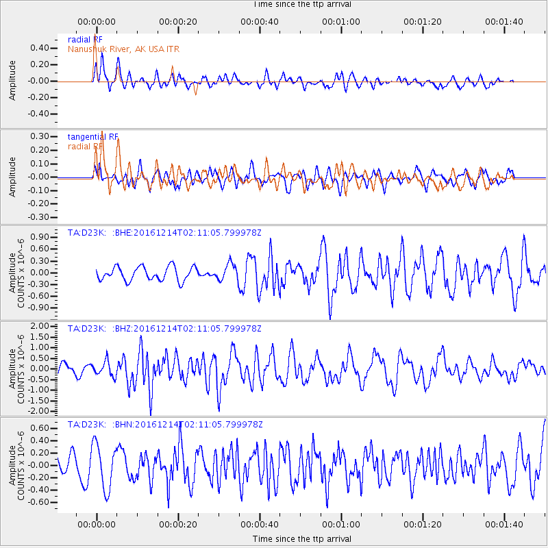
D23K Nanushuk River, AK USA - Earthquake Result Viewer
*The percent match for this event was below the threshold and hence no stack was calculated.
| Earthquake location: |
Mariana Islands Region |
| Earthquake latitude/longitude: |
21.3/144.4 |
| Earthquake time(UTC): |
2016/12/14 (349) 02:01:23 GMT |
| Earthquake Depth: |
28 km |
| Earthquake Magnitude: |
6.0 Mww |
| Earthquake Catalog/Contributor: |
NEIC PDE/us |
|
| Network: |
TA USArray Transportable Network (new EarthScope stations) |
| Station: |
D23K Nanushuk River, AK USA |
| Lat/Lon: |
68.97 N/150.68 W |
| Elevation: |
406 m |
|
| Distance: |
61.3 deg |
| Az: |
21.874 deg |
| Baz: |
254.229 deg |
| Ray Param: |
$rayparam |
*The percent match for this event was below the threshold and hence was not used in the summary stack. |
|
| Radial Match: |
58.7066 % |
| Radial Bump: |
400 |
| Transverse Match: |
61.94088 % |
| Transverse Bump: |
400 |
| SOD ConfigId: |
11737051 |
| Insert Time: |
2019-04-26 07:48:39.566 +0000 |
| GWidth: |
2.5 |
| Max Bumps: |
400 |
| Tol: |
0.001 |
|
Signal To Noise
| Channel | StoN | STA | LTA |
| TA:D23K: :BHZ:20161214T02:11:05.799978Z | 1.3829855 | 3.4468007E-7 | 2.49229E-7 |
| TA:D23K: :BHN:20161214T02:11:05.799978Z | 2.4838011 | 3.6696608E-7 | 1.4774375E-7 |
| TA:D23K: :BHE:20161214T02:11:05.799978Z | 1.3269651 | 2.3110853E-7 | 1.7416322E-7 |
| Arrivals |
| Ps | |
| PpPs | |
| PsPs/PpSs | |


