You are here: Home > Network List > UW - Pacific Northwest Regional Seismic Network Stations List
> Station MRBL Marblemount, WA, USA > Earthquake Result Viewer
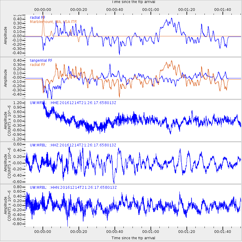
MRBL Marblemount, WA, USA - Earthquake Result Viewer
*The percent match for this event was below the threshold and hence no stack was calculated.
| Earthquake location: |
Mariana Islands Region |
| Earthquake latitude/longitude: |
21.4/144.3 |
| Earthquake time(UTC): |
2016/12/14 (349) 21:14:58 GMT |
| Earthquake Depth: |
31 km |
| Earthquake Magnitude: |
5.5 mb |
| Earthquake Catalog/Contributor: |
NEIC PDE/us |
|
| Network: |
UW Pacific Northwest Regional Seismic Network |
| Station: |
MRBL Marblemount, WA, USA |
| Lat/Lon: |
48.52 N/121.48 W |
| Elevation: |
75 m |
|
| Distance: |
77.0 deg |
| Az: |
42.892 deg |
| Baz: |
287.429 deg |
| Ray Param: |
$rayparam |
*The percent match for this event was below the threshold and hence was not used in the summary stack. |
|
| Radial Match: |
23.75956 % |
| Radial Bump: |
400 |
| Transverse Match: |
41.451443 % |
| Transverse Bump: |
400 |
| SOD ConfigId: |
11737051 |
| Insert Time: |
2019-04-26 07:57:31.628 +0000 |
| GWidth: |
2.5 |
| Max Bumps: |
400 |
| Tol: |
0.001 |
|
Signal To Noise
| Channel | StoN | STA | LTA |
| UW:MRBL: :HHZ:20161214T21:26:17.658013Z | 1.0567765 | 1.1860321E-7 | 1.1223112E-7 |
| UW:MRBL: :HHN:20161214T21:26:17.658013Z | 1.268427 | 3.0206596E-7 | 2.3814216E-7 |
| UW:MRBL: :HHE:20161214T21:26:17.658013Z | 1.5578783 | 5.965647E-7 | 3.8293408E-7 |
| Arrivals |
| Ps | |
| PpPs | |
| PsPs/PpSs | |


