You are here: Home > Network List > AZ - ANZA Regional Network Stations List
> Station SMER AZ.SMER > Earthquake Result Viewer
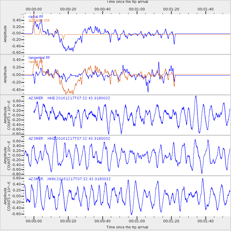
SMER AZ.SMER - Earthquake Result Viewer
*The percent match for this event was below the threshold and hence no stack was calculated.
| Earthquake location: |
Near Coast Of Peru |
| Earthquake latitude/longitude: |
-10.9/-78.8 |
| Earthquake time(UTC): |
2016/12/17 (352) 07:23:30 GMT |
| Earthquake Depth: |
38 km |
| Earthquake Magnitude: |
5.0 mb |
| Earthquake Catalog/Contributor: |
NEIC PDE/us |
|
| Network: |
AZ ANZA Regional Network |
| Station: |
SMER AZ.SMER |
| Lat/Lon: |
33.46 N/117.17 W |
| Elevation: |
355 m |
|
| Distance: |
57.3 deg |
| Az: |
321.905 deg |
| Baz: |
133.539 deg |
| Ray Param: |
$rayparam |
*The percent match for this event was below the threshold and hence was not used in the summary stack. |
|
| Radial Match: |
62.70918 % |
| Radial Bump: |
400 |
| Transverse Match: |
64.78321 % |
| Transverse Bump: |
400 |
| SOD ConfigId: |
11737051 |
| Insert Time: |
2019-04-26 08:00:08.026 +0000 |
| GWidth: |
2.5 |
| Max Bumps: |
400 |
| Tol: |
0.001 |
|
Signal To Noise
| Channel | StoN | STA | LTA |
| AZ:SMER: :HHZ:20161217T07:32:43.918003Z | 0.9521992 | 2.4234006E-7 | 2.5450564E-7 |
| AZ:SMER: :HHN:20161217T07:32:43.918003Z | 1.2069978 | 4.222319E-7 | 3.4981994E-7 |
| AZ:SMER: :HHE:20161217T07:32:43.918003Z | 0.52509713 | 1.0938844E-7 | 2.0832039E-7 |
| Arrivals |
| Ps | |
| PpPs | |
| PsPs/PpSs | |


