You are here: Home > Network List > GS - US Geological Survey Networks Stations List
> Station DEC12 Decatur Surface Seismic Site, Decatur, IL, USA > Earthquake Result Viewer
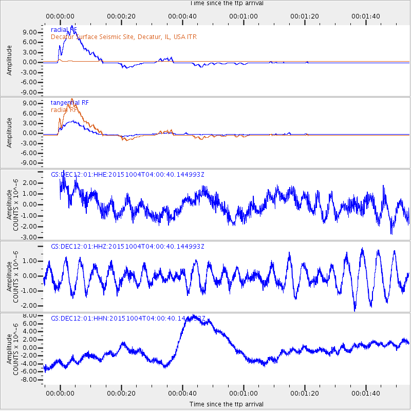
DEC12 Decatur Surface Seismic Site, Decatur, IL, USA - Earthquake Result Viewer
*The percent match for this event was below the threshold and hence no stack was calculated.
| Earthquake location: |
Off Coast Of Central Chile |
| Earthquake latitude/longitude: |
-30.3/-72.1 |
| Earthquake time(UTC): |
2015/10/04 (277) 03:49:49 GMT |
| Earthquake Depth: |
4.9 km |
| Earthquake Magnitude: |
5.5 MWW, 5.3 MWR |
| Earthquake Catalog/Contributor: |
NEIC PDE/NEIC COMCAT |
|
| Network: |
GS US Geological Survey Networks |
| Station: |
DEC12 Decatur Surface Seismic Site, Decatur, IL, USA |
| Lat/Lon: |
39.91 N/88.91 W |
| Elevation: |
208 m |
|
| Distance: |
71.6 deg |
| Az: |
346.449 deg |
| Baz: |
164.725 deg |
| Ray Param: |
$rayparam |
*The percent match for this event was below the threshold and hence was not used in the summary stack. |
|
| Radial Match: |
53.081562 % |
| Radial Bump: |
400 |
| Transverse Match: |
57.748295 % |
| Transverse Bump: |
400 |
| SOD ConfigId: |
1259291 |
| Insert Time: |
2015-11-08 02:32:33.434 +0000 |
| GWidth: |
2.5 |
| Max Bumps: |
400 |
| Tol: |
0.001 |
|
Signal To Noise
| Channel | StoN | STA | LTA |
| GS:DEC12:01:HHZ:20151004T04:00:40.144993Z | 1.6705809 | 8.130909E-7 | 4.867115E-7 |
| GS:DEC12:01:HHN:20151004T04:00:40.144993Z | 1.5341887 | 9.441256E-6 | 6.153908E-6 |
| GS:DEC12:01:HHE:20151004T04:00:40.144993Z | 1.360878 | 1.3334296E-6 | 9.798304E-7 |
| Arrivals |
| Ps | |
| PpPs | |
| PsPs/PpSs | |


