You are here: Home > Network List > TA - USArray Transportable Network (new EarthScope stations) Stations List
> Station I23K Minto, Yukon-Koyukuk, AK, USA > Earthquake Result Viewer
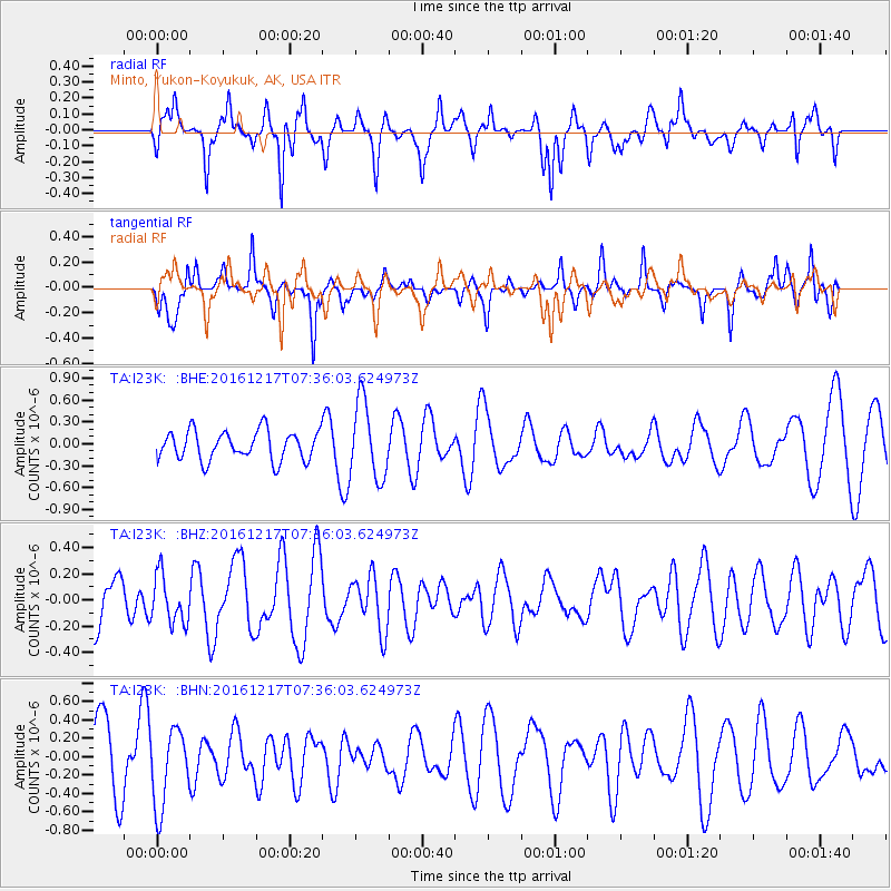
I23K Minto, Yukon-Koyukuk, AK, USA - Earthquake Result Viewer
*The percent match for this event was below the threshold and hence no stack was calculated.
| Earthquake location: |
Near Coast Of Peru |
| Earthquake latitude/longitude: |
-10.9/-78.8 |
| Earthquake time(UTC): |
2016/12/17 (352) 07:23:30 GMT |
| Earthquake Depth: |
38 km |
| Earthquake Magnitude: |
5.0 mb |
| Earthquake Catalog/Contributor: |
NEIC PDE/us |
|
| Network: |
TA USArray Transportable Network (new EarthScope stations) |
| Station: |
I23K Minto, Yukon-Koyukuk, AK, USA |
| Lat/Lon: |
65.15 N/149.36 W |
| Elevation: |
149 m |
|
| Distance: |
91.8 deg |
| Az: |
336.501 deg |
| Baz: |
112.069 deg |
| Ray Param: |
$rayparam |
*The percent match for this event was below the threshold and hence was not used in the summary stack. |
|
| Radial Match: |
48.559185 % |
| Radial Bump: |
313 |
| Transverse Match: |
58.21574 % |
| Transverse Bump: |
331 |
| SOD ConfigId: |
11737051 |
| Insert Time: |
2019-04-26 08:05:30.721 +0000 |
| GWidth: |
2.5 |
| Max Bumps: |
400 |
| Tol: |
0.001 |
|
Signal To Noise
| Channel | StoN | STA | LTA |
| TA:I23K: :BHZ:20161217T07:36:03.624973Z | 0.7217272 | 1.8442938E-7 | 2.555389E-7 |
| TA:I23K: :BHN:20161217T07:36:03.624973Z | 1.0244083 | 4.2518082E-7 | 4.1505012E-7 |
| TA:I23K: :BHE:20161217T07:36:03.624973Z | 2.6197748 | 5.2328124E-7 | 1.9974283E-7 |
| Arrivals |
| Ps | |
| PpPs | |
| PsPs/PpSs | |


