You are here: Home > Network List > CI - Caltech Regional Seismic Network Stations List
> Station MPM Manuel Prospect Mine, California, USA > Earthquake Result Viewer
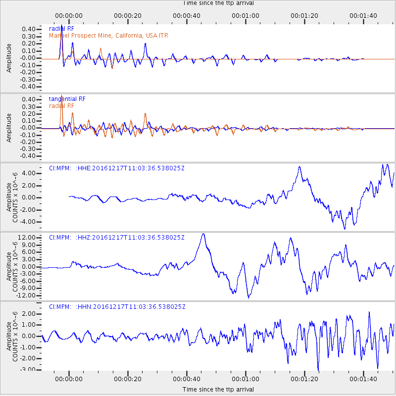
MPM Manuel Prospect Mine, California, USA - Earthquake Result Viewer
*The percent match for this event was below the threshold and hence no stack was calculated.
| Earthquake location: |
New Ireland Region, P.N.G. |
| Earthquake latitude/longitude: |
-4.5/153.6 |
| Earthquake time(UTC): |
2016/12/17 (352) 10:51:11 GMT |
| Earthquake Depth: |
73 km |
| Earthquake Magnitude: |
8.0 Mi |
| Earthquake Catalog/Contributor: |
NEIC PDE/pt |
|
| Network: |
CI Caltech Regional Seismic Network |
| Station: |
MPM Manuel Prospect Mine, California, USA |
| Lat/Lon: |
36.06 N/117.49 W |
| Elevation: |
185 m |
|
| Distance: |
91.7 deg |
| Az: |
54.148 deg |
| Baz: |
265.774 deg |
| Ray Param: |
$rayparam |
*The percent match for this event was below the threshold and hence was not used in the summary stack. |
|
| Radial Match: |
97.36145 % |
| Radial Bump: |
400 |
| Transverse Match: |
82.747826 % |
| Transverse Bump: |
400 |
| SOD ConfigId: |
11737051 |
| Insert Time: |
2019-04-26 08:11:33.470 +0000 |
| GWidth: |
2.5 |
| Max Bumps: |
400 |
| Tol: |
0.001 |
|
Signal To Noise
| Channel | StoN | STA | LTA |
| CI:MPM: :HHZ:20161217T11:03:36.538025Z | 8.016423 | 1.3024868E-6 | 1.6247729E-7 |
| CI:MPM: :HHN:20161217T11:03:36.538025Z | 1.0785941 | 2.3683636E-7 | 2.1957877E-7 |
| CI:MPM: :HHE:20161217T11:03:36.538025Z | 1.7458757 | 5.2872343E-7 | 3.028414E-7 |
| Arrivals |
| Ps | |
| PpPs | |
| PsPs/PpSs | |


