You are here: Home > Network List > CI - Caltech Regional Seismic Network Stations List
> Station MPP McPhearson Peak > Earthquake Result Viewer
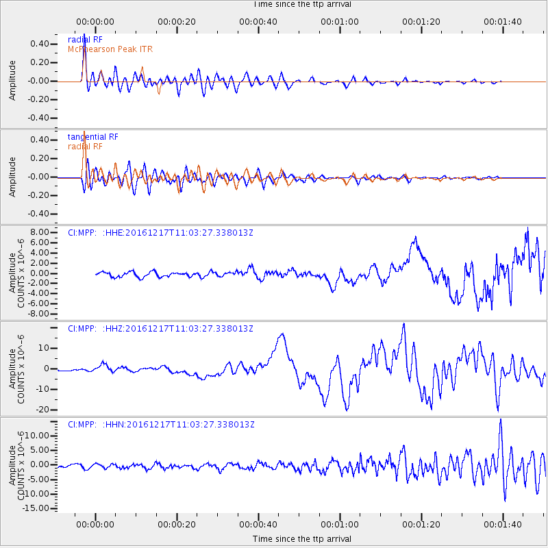
MPP McPhearson Peak - Earthquake Result Viewer
*The percent match for this event was below the threshold and hence no stack was calculated.
| Earthquake location: |
New Ireland Region, P.N.G. |
| Earthquake latitude/longitude: |
-4.5/153.6 |
| Earthquake time(UTC): |
2016/12/17 (352) 10:51:11 GMT |
| Earthquake Depth: |
73 km |
| Earthquake Magnitude: |
8.0 Mi |
| Earthquake Catalog/Contributor: |
NEIC PDE/pt |
|
| Network: |
CI Caltech Regional Seismic Network |
| Station: |
MPP McPhearson Peak |
| Lat/Lon: |
34.89 N/119.81 W |
| Elevation: |
1739 m |
|
| Distance: |
89.8 deg |
| Az: |
55.148 deg |
| Baz: |
264.418 deg |
| Ray Param: |
$rayparam |
*The percent match for this event was below the threshold and hence was not used in the summary stack. |
|
| Radial Match: |
92.0032 % |
| Radial Bump: |
400 |
| Transverse Match: |
86.445724 % |
| Transverse Bump: |
400 |
| SOD ConfigId: |
11737051 |
| Insert Time: |
2019-04-26 08:11:34.642 +0000 |
| GWidth: |
2.5 |
| Max Bumps: |
400 |
| Tol: |
0.001 |
|
Signal To Noise
| Channel | StoN | STA | LTA |
| CI:MPP: :HHZ:20161217T11:03:27.338013Z | 3.4142206 | 1.8964794E-6 | 5.554648E-7 |
| CI:MPP: :HHN:20161217T11:03:27.338013Z | 1.0787115 | 6.8924606E-7 | 6.389531E-7 |
| CI:MPP: :HHE:20161217T11:03:27.338013Z | 1.1718045 | 5.5441586E-7 | 4.7313E-7 |
| Arrivals |
| Ps | |
| PpPs | |
| PsPs/PpSs | |


