You are here: Home > Network List > TA - USArray Transportable Network (new EarthScope stations) Stations List
> Station D25K Kavik River, AK, USA > Earthquake Result Viewer
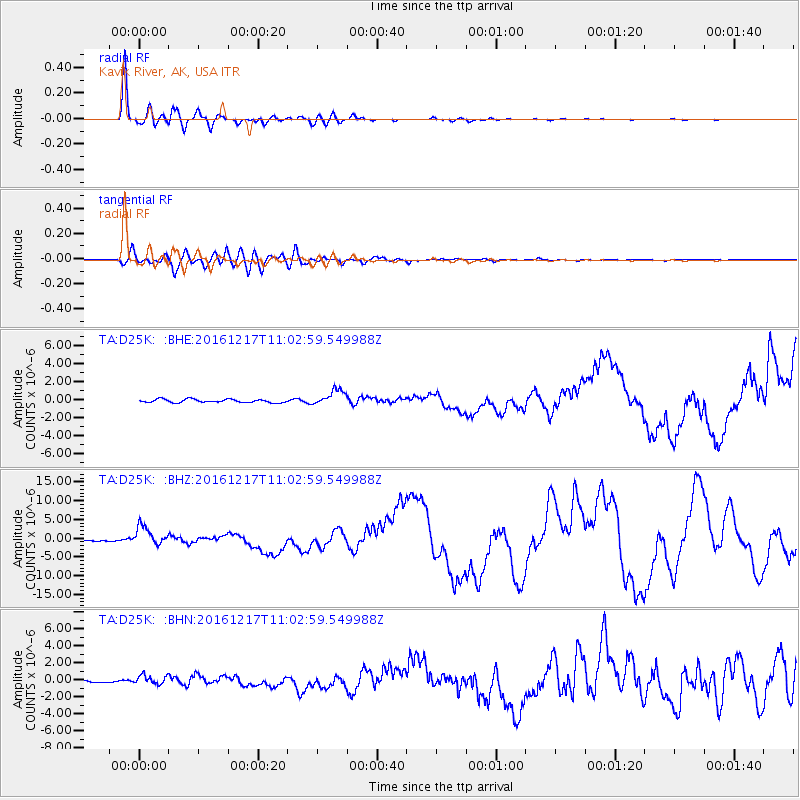
D25K Kavik River, AK, USA - Earthquake Result Viewer
*The percent match for this event was below the threshold and hence no stack was calculated.
| Earthquake location: |
New Ireland Region, P.N.G. |
| Earthquake latitude/longitude: |
-4.5/153.6 |
| Earthquake time(UTC): |
2016/12/17 (352) 10:51:11 GMT |
| Earthquake Depth: |
73 km |
| Earthquake Magnitude: |
8.0 Mi |
| Earthquake Catalog/Contributor: |
NEIC PDE/pt |
|
| Network: |
TA USArray Transportable Network (new EarthScope stations) |
| Station: |
D25K Kavik River, AK, USA |
| Lat/Lon: |
69.32 N/146.38 W |
| Elevation: |
770 m |
|
| Distance: |
84.0 deg |
| Az: |
18.026 deg |
| Baz: |
240.294 deg |
| Ray Param: |
$rayparam |
*The percent match for this event was below the threshold and hence was not used in the summary stack. |
|
| Radial Match: |
98.20477 % |
| Radial Bump: |
321 |
| Transverse Match: |
89.46732 % |
| Transverse Bump: |
400 |
| SOD ConfigId: |
11737051 |
| Insert Time: |
2019-04-26 08:15:07.600 +0000 |
| GWidth: |
2.5 |
| Max Bumps: |
400 |
| Tol: |
0.001 |
|
Signal To Noise
| Channel | StoN | STA | LTA |
| TA:D25K: :BHZ:20161217T11:02:59.549988Z | 21.168573 | 2.5652546E-6 | 1.2118221E-7 |
| TA:D25K: :BHN:20161217T11:02:59.549988Z | 2.61046 | 5.56507E-7 | 2.131835E-7 |
| TA:D25K: :BHE:20161217T11:02:59.549988Z | 4.5471663 | 8.8485876E-7 | 1.9459566E-7 |
| Arrivals |
| Ps | |
| PpPs | |
| PsPs/PpSs | |


