You are here: Home > Network List > TA - USArray Transportable Network (new EarthScope stations) Stations List
> Station G21K Allakaket, AK, USA > Earthquake Result Viewer
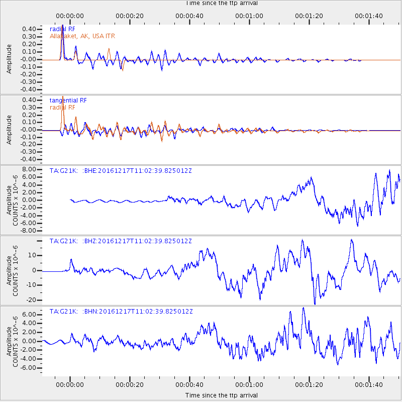
G21K Allakaket, AK, USA - Earthquake Result Viewer
*The percent match for this event was below the threshold and hence no stack was calculated.
| Earthquake location: |
New Ireland Region, P.N.G. |
| Earthquake latitude/longitude: |
-4.5/153.6 |
| Earthquake time(UTC): |
2016/12/17 (352) 10:51:11 GMT |
| Earthquake Depth: |
73 km |
| Earthquake Magnitude: |
8.0 Mi |
| Earthquake Catalog/Contributor: |
NEIC PDE/pt |
|
| Network: |
TA USArray Transportable Network (new EarthScope stations) |
| Station: |
G21K Allakaket, AK, USA |
| Lat/Lon: |
66.52 N/153.51 W |
| Elevation: |
446 m |
|
| Distance: |
80.2 deg |
| Az: |
18.931 deg |
| Baz: |
233.814 deg |
| Ray Param: |
$rayparam |
*The percent match for this event was below the threshold and hence was not used in the summary stack. |
|
| Radial Match: |
97.57993 % |
| Radial Bump: |
344 |
| Transverse Match: |
87.37274 % |
| Transverse Bump: |
400 |
| SOD ConfigId: |
11737051 |
| Insert Time: |
2019-04-26 08:15:16.141 +0000 |
| GWidth: |
2.5 |
| Max Bumps: |
400 |
| Tol: |
0.001 |
|
Signal To Noise
| Channel | StoN | STA | LTA |
| TA:G21K: :BHZ:20161217T11:02:39.825012Z | 14.119875 | 2.8945028E-6 | 2.0499493E-7 |
| TA:G21K: :BHN:20161217T11:02:39.825012Z | 2.7182858 | 8.0640825E-7 | 2.966606E-7 |
| TA:G21K: :BHE:20161217T11:02:39.825012Z | 3.198547 | 6.5212595E-7 | 2.0388194E-7 |
| Arrivals |
| Ps | |
| PpPs | |
| PsPs/PpSs | |


