You are here: Home > Network List > CI - Caltech Regional Seismic Network Stations List
> Station SWS Sam W. Stewart, Westmorland, CA, USA > Earthquake Result Viewer
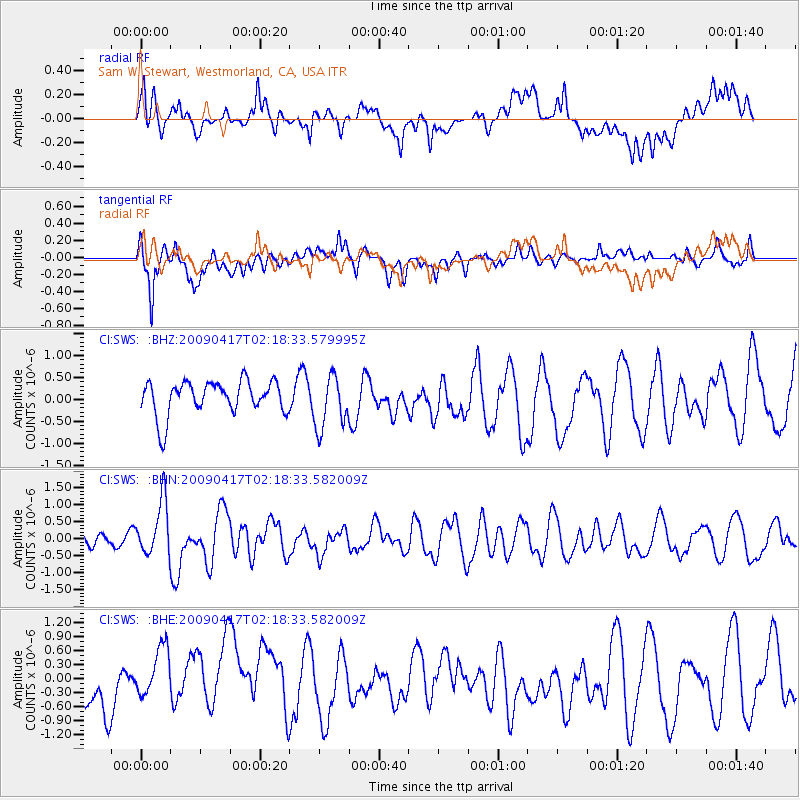
SWS Sam W. Stewart, Westmorland, CA, USA - Earthquake Result Viewer
*The percent match for this event was below the threshold and hence no stack was calculated.
| Earthquake location: |
Near Coast Of Northern Chile |
| Earthquake latitude/longitude: |
-19.6/-70.5 |
| Earthquake time(UTC): |
2009/04/17 (107) 02:08:08 GMT |
| Earthquake Depth: |
25 km |
| Earthquake Magnitude: |
5.8 MB, 5.8 MS, 6.1 MW, 6.1 MW |
| Earthquake Catalog/Contributor: |
WHDF/NEIC |
|
| Network: |
CI Caltech Regional Seismic Network |
| Station: |
SWS Sam W. Stewart, Westmorland, CA, USA |
| Lat/Lon: |
32.94 N/115.80 W |
| Elevation: |
140 m |
|
| Distance: |
67.8 deg |
| Az: |
319.795 deg |
| Baz: |
133.63 deg |
| Ray Param: |
$rayparam |
*The percent match for this event was below the threshold and hence was not used in the summary stack. |
|
| Radial Match: |
55.175037 % |
| Radial Bump: |
400 |
| Transverse Match: |
67.04192 % |
| Transverse Bump: |
400 |
| SOD ConfigId: |
2658 |
| Insert Time: |
2010-03-05 20:35:32.969 +0000 |
| GWidth: |
2.5 |
| Max Bumps: |
400 |
| Tol: |
0.001 |
|
Signal To Noise
| Channel | StoN | STA | LTA |
| CI:SWS: :BHN:20090417T02:18:33.582009Z | 3.4705966 | 7.8997493E-7 | 2.2761935E-7 |
| CI:SWS: :BHE:20090417T02:18:33.582009Z | 1.1214187 | 5.415298E-7 | 4.8289706E-7 |
| CI:SWS: :BHZ:20090417T02:18:33.579995Z | 1.5847877 | 6.097523E-7 | 3.8475332E-7 |
| Arrivals |
| Ps | |
| PpPs | |
| PsPs/PpSs | |


