You are here: Home > Network List > CI - Caltech Regional Seismic Network Stations List
> Station SDD Saddleback, Mission Viejo, CA, USA > Earthquake Result Viewer
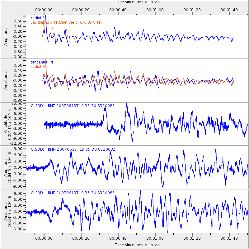
SDD Saddleback, Mission Viejo, CA, USA - Earthquake Result Viewer

| Earthquake location: |
Near Coast Of Guatemala |
| Earthquake latitude/longitude: |
13.6/-90.6 |
| Earthquake time(UTC): |
2007/06/13 (164) 19:29:40 GMT |
| Earthquake Depth: |
23 km |
| Earthquake Magnitude: |
5.9 MB, 6.5 MS, 6.7 MW, 6.5 MW |
| Earthquake Catalog/Contributor: |
WHDF/NEIC |
|
| Network: |
CI Caltech Regional Seismic Network |
| Station: |
SDD Saddleback, Mission Viejo, CA, USA |
| Lat/Lon: |
33.55 N/117.66 W |
| Elevation: |
120 m |
|
| Distance: |
31.6 deg |
| Az: |
313.617 deg |
| Baz: |
122.531 deg |
| Ray Param: |
0.07896791 |
| Estimated Moho Depth: |
47.0 km |
| Estimated Crust Vp/Vs: |
2.02 |
| Assumed Crust Vp: |
6.264 km/s |
| Estimated Crust Vs: |
3.105 km/s |
| Estimated Crust Poisson's Ratio: |
0.34 |
|
| Radial Match: |
83.686516 % |
| Radial Bump: |
400 |
| Transverse Match: |
77.30082 % |
| Transverse Bump: |
400 |
| SOD ConfigId: |
2564 |
| Insert Time: |
2010-02-26 00:56:47.907 +0000 |
| GWidth: |
2.5 |
| Max Bumps: |
400 |
| Tol: |
0.001 |
|
Signal To Noise
| Channel | StoN | STA | LTA |
| CI:SDD: :BHN:20070613T19:35:30.832008Z | 2.489591 | 1.737478E-6 | 6.97897E-7 |
| CI:SDD: :BHE:20070613T19:35:30.832008Z | 2.8900719 | 2.366558E-6 | 8.188578E-7 |
| CI:SDD: :BHZ:20070613T19:35:30.832008Z | 4.8580713 | 4.664462E-6 | 9.601467E-7 |
| Arrivals |
| Ps | 8.2 SECOND |
| PpPs | 21 SECOND |
| PsPs/PpSs | 29 SECOND |


