You are here: Home > Network List > TA - USArray Transportable Network (new EarthScope stations) Stations List
> Station R31K City Hall, Gustavus, AK, USA > Earthquake Result Viewer
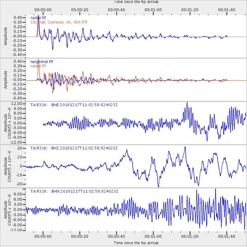
R31K City Hall, Gustavus, AK, USA - Earthquake Result Viewer
*The percent match for this event was below the threshold and hence no stack was calculated.
| Earthquake location: |
New Ireland Region, P.N.G. |
| Earthquake latitude/longitude: |
-4.5/153.6 |
| Earthquake time(UTC): |
2016/12/17 (352) 10:51:11 GMT |
| Earthquake Depth: |
73 km |
| Earthquake Magnitude: |
8.0 Mi |
| Earthquake Catalog/Contributor: |
NEIC PDE/pt |
|
| Network: |
TA USArray Transportable Network (new EarthScope stations) |
| Station: |
R31K City Hall, Gustavus, AK, USA |
| Lat/Lon: |
58.41 N/135.74 W |
| Elevation: |
15 m |
|
| Distance: |
83.8 deg |
| Az: |
29.975 deg |
| Baz: |
251.151 deg |
| Ray Param: |
$rayparam |
*The percent match for this event was below the threshold and hence was not used in the summary stack. |
|
| Radial Match: |
89.274 % |
| Radial Bump: |
400 |
| Transverse Match: |
57.526566 % |
| Transverse Bump: |
400 |
| SOD ConfigId: |
11737051 |
| Insert Time: |
2019-04-26 08:16:14.923 +0000 |
| GWidth: |
2.5 |
| Max Bumps: |
400 |
| Tol: |
0.001 |
|
Signal To Noise
| Channel | StoN | STA | LTA |
| TA:R31K: :BHZ:20161217T11:02:58.624023Z | 5.63683 | 2.6395824E-6 | 4.6827427E-7 |
| TA:R31K: :BHN:20161217T11:02:58.624023Z | 0.44458425 | 6.6124346E-7 | 1.48733E-6 |
| TA:R31K: :BHE:20161217T11:02:58.624023Z | 0.93557394 | 1.6096501E-6 | 1.7204949E-6 |
| Arrivals |
| Ps | |
| PpPs | |
| PsPs/PpSs | |


