You are here: Home > Network List > TA - USArray Transportable Network (new EarthScope stations) Stations List
> Station R33M Jennings River, BC, CAN > Earthquake Result Viewer
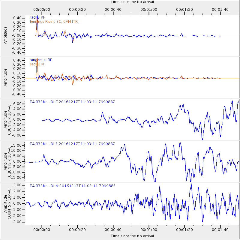
R33M Jennings River, BC, CAN - Earthquake Result Viewer
*The percent match for this event was below the threshold and hence no stack was calculated.
| Earthquake location: |
New Ireland Region, P.N.G. |
| Earthquake latitude/longitude: |
-4.5/153.6 |
| Earthquake time(UTC): |
2016/12/17 (352) 10:51:11 GMT |
| Earthquake Depth: |
73 km |
| Earthquake Magnitude: |
8.0 Mi |
| Earthquake Catalog/Contributor: |
NEIC PDE/pt |
|
| Network: |
TA USArray Transportable Network (new EarthScope stations) |
| Station: |
R33M Jennings River, BC, CAN |
| Lat/Lon: |
59.39 N/130.97 W |
| Elevation: |
1437 m |
|
| Distance: |
86.5 deg |
| Az: |
29.749 deg |
| Baz: |
255.212 deg |
| Ray Param: |
$rayparam |
*The percent match for this event was below the threshold and hence was not used in the summary stack. |
|
| Radial Match: |
97.90726 % |
| Radial Bump: |
300 |
| Transverse Match: |
87.68531 % |
| Transverse Bump: |
400 |
| SOD ConfigId: |
11737051 |
| Insert Time: |
2019-04-26 08:16:16.261 +0000 |
| GWidth: |
2.5 |
| Max Bumps: |
400 |
| Tol: |
0.001 |
|
Signal To Noise
| Channel | StoN | STA | LTA |
| TA:R33M: :BHZ:20161217T11:03:11.799988Z | 9.310031 | 2.652615E-6 | 2.8492013E-7 |
| TA:R33M: :BHN:20161217T11:03:11.799988Z | 1.9328926 | 3.490221E-7 | 1.8056984E-7 |
| TA:R33M: :BHE:20161217T11:03:11.799988Z | 4.7897935 | 1.3230195E-6 | 2.762164E-7 |
| Arrivals |
| Ps | |
| PpPs | |
| PsPs/PpSs | |


