You are here: Home > Network List > CI - Caltech Regional Seismic Network Stations List
> Station SWS Sam W. Stewart, Westmorland, CA, USA > Earthquake Result Viewer
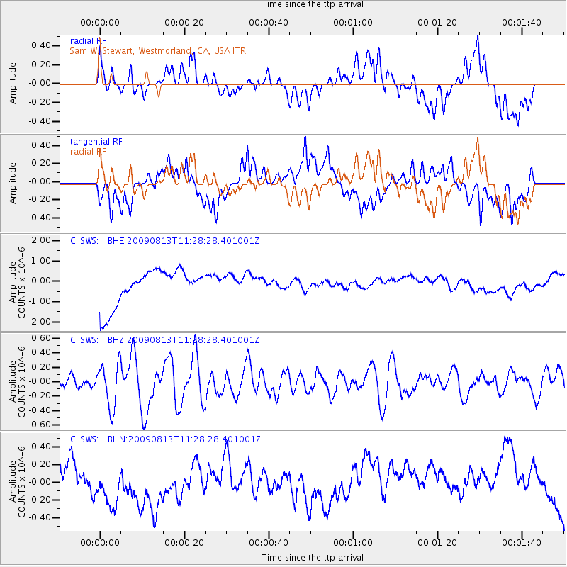
SWS Sam W. Stewart, Westmorland, CA, USA - Earthquake Result Viewer
*The percent match for this event was below the threshold and hence no stack was calculated.
| Earthquake location: |
Tonga Islands |
| Earthquake latitude/longitude: |
-21.7/-174.6 |
| Earthquake time(UTC): |
2009/08/13 (225) 11:17:01 GMT |
| Earthquake Depth: |
10 km |
| Earthquake Magnitude: |
5.6 MW, 5.3 MB |
| Earthquake Catalog/Contributor: |
WHDF/NEIC |
|
| Network: |
CI Caltech Regional Seismic Network |
| Station: |
SWS Sam W. Stewart, Westmorland, CA, USA |
| Lat/Lon: |
32.94 N/115.80 W |
| Elevation: |
140 m |
|
| Distance: |
78.1 deg |
| Az: |
47.303 deg |
| Baz: |
234.392 deg |
| Ray Param: |
$rayparam |
*The percent match for this event was below the threshold and hence was not used in the summary stack. |
|
| Radial Match: |
18.51156 % |
| Radial Bump: |
400 |
| Transverse Match: |
16.988256 % |
| Transverse Bump: |
400 |
| SOD ConfigId: |
2622 |
| Insert Time: |
2010-03-05 20:36:24.159 +0000 |
| GWidth: |
2.5 |
| Max Bumps: |
400 |
| Tol: |
0.001 |
|
Signal To Noise
| Channel | StoN | STA | LTA |
| CI:SWS: :BHZ:20090813T11:28:28.401001Z | 5.2568426 | 3.0176815E-7 | 5.740483E-8 |
| CI:SWS: :BHN:20090813T11:28:28.401001Z | 1.4466629 | 2.4289523E-7 | 1.6790037E-7 |
| CI:SWS: :BHE:20090813T11:28:28.401001Z | 0.51555794 | 4.4496488E-7 | 8.630745E-7 |
| Arrivals |
| Ps | |
| PpPs | |
| PsPs/PpSs | |


