You are here: Home > Network List > CI - Caltech Regional Seismic Network Stations List
> Station SWS Sam W. Stewart, Westmorland, CA, USA > Earthquake Result Viewer
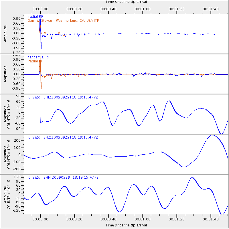
SWS Sam W. Stewart, Westmorland, CA, USA - Earthquake Result Viewer
*The percent match for this event was below the threshold and hence no stack was calculated.
| Earthquake location: |
Samoa Islands Region |
| Earthquake latitude/longitude: |
-15.6/-172.0 |
| Earthquake time(UTC): |
2009/09/29 (272) 18:08:21 GMT |
| Earthquake Depth: |
10 km |
| Earthquake Magnitude: |
5.6 MB |
| Earthquake Catalog/Contributor: |
WHDF/NEIC |
|
| Network: |
CI Caltech Regional Seismic Network |
| Station: |
SWS Sam W. Stewart, Westmorland, CA, USA |
| Lat/Lon: |
32.94 N/115.80 W |
| Elevation: |
140 m |
|
| Distance: |
72.2 deg |
| Az: |
47.243 deg |
| Baz: |
237.307 deg |
| Ray Param: |
$rayparam |
*The percent match for this event was below the threshold and hence was not used in the summary stack. |
|
| Radial Match: |
52.211052 % |
| Radial Bump: |
400 |
| Transverse Match: |
35.634556 % |
| Transverse Bump: |
278 |
| SOD ConfigId: |
2622 |
| Insert Time: |
2010-03-05 20:36:35.707 +0000 |
| GWidth: |
2.5 |
| Max Bumps: |
400 |
| Tol: |
0.001 |
|
Signal To Noise
| Channel | StoN | STA | LTA |
| CI:SWS: :BHZ:20090929T18:19:15.477Z | 0.85620797 | 1.47312E-5 | 1.7205166E-5 |
| CI:SWS: :BHN:20090929T18:19:15.477Z | 2.1928754 | 7.133034E-5 | 3.2528224E-5 |
| CI:SWS: :BHE:20090929T18:19:15.477Z | 2.8048275 | 7.0550144E-5 | 2.5153113E-5 |
| Arrivals |
| Ps | |
| PpPs | |
| PsPs/PpSs | |


