You are here: Home > Network List > CI - Caltech Regional Seismic Network Stations List
> Station SWS Sam W. Stewart, Westmorland, CA, USA > Earthquake Result Viewer
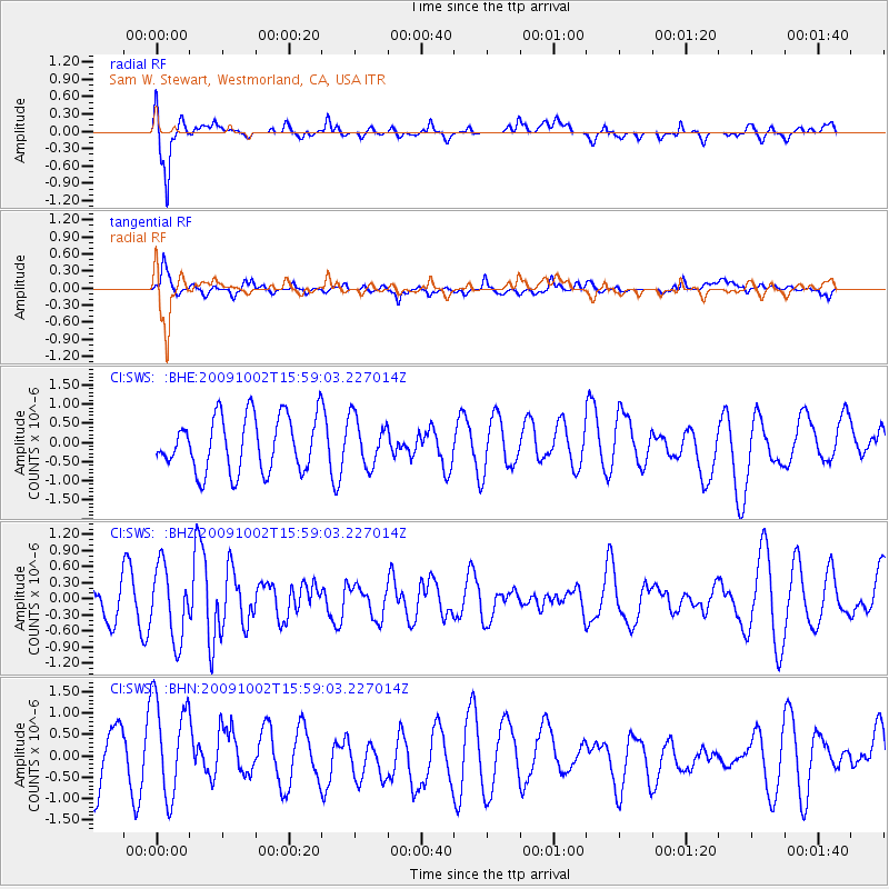
SWS Sam W. Stewart, Westmorland, CA, USA - Earthquake Result Viewer
*The percent match for this event was below the threshold and hence no stack was calculated.
| Earthquake location: |
Fiji Islands Region |
| Earthquake latitude/longitude: |
-17.0/174.5 |
| Earthquake time(UTC): |
2009/10/02 (275) 15:47:09 GMT |
| Earthquake Depth: |
10 km |
| Earthquake Magnitude: |
5.7 MB, 5.6 MS, 6.0 MW, 5.8 MW |
| Earthquake Catalog/Contributor: |
WHDF/NEIC |
|
| Network: |
CI Caltech Regional Seismic Network |
| Station: |
SWS Sam W. Stewart, Westmorland, CA, USA |
| Lat/Lon: |
32.94 N/115.80 W |
| Elevation: |
140 m |
|
| Distance: |
83.0 deg |
| Az: |
52.615 deg |
| Baz: |
244.697 deg |
| Ray Param: |
$rayparam |
*The percent match for this event was below the threshold and hence was not used in the summary stack. |
|
| Radial Match: |
71.72283 % |
| Radial Bump: |
400 |
| Transverse Match: |
66.102844 % |
| Transverse Bump: |
400 |
| SOD ConfigId: |
2622 |
| Insert Time: |
2010-03-05 20:36:37.311 +0000 |
| GWidth: |
2.5 |
| Max Bumps: |
400 |
| Tol: |
0.001 |
|
Signal To Noise
| Channel | StoN | STA | LTA |
| CI:SWS: :BHZ:20091002T15:59:03.227014Z | 1.6501576 | 6.7288715E-7 | 4.0777144E-7 |
| CI:SWS: :BHN:20091002T15:59:03.227014Z | 1.8309094 | 1.1986988E-6 | 6.547013E-7 |
| CI:SWS: :BHE:20091002T15:59:03.227014Z | 0.8801926 | 6.254892E-7 | 7.1062766E-7 |
| Arrivals |
| Ps | |
| PpPs | |
| PsPs/PpSs | |


