You are here: Home > Network List > CI - Caltech Regional Seismic Network Stations List
> Station SWS Sam W. Stewart, Westmorland, CA, USA > Earthquake Result Viewer
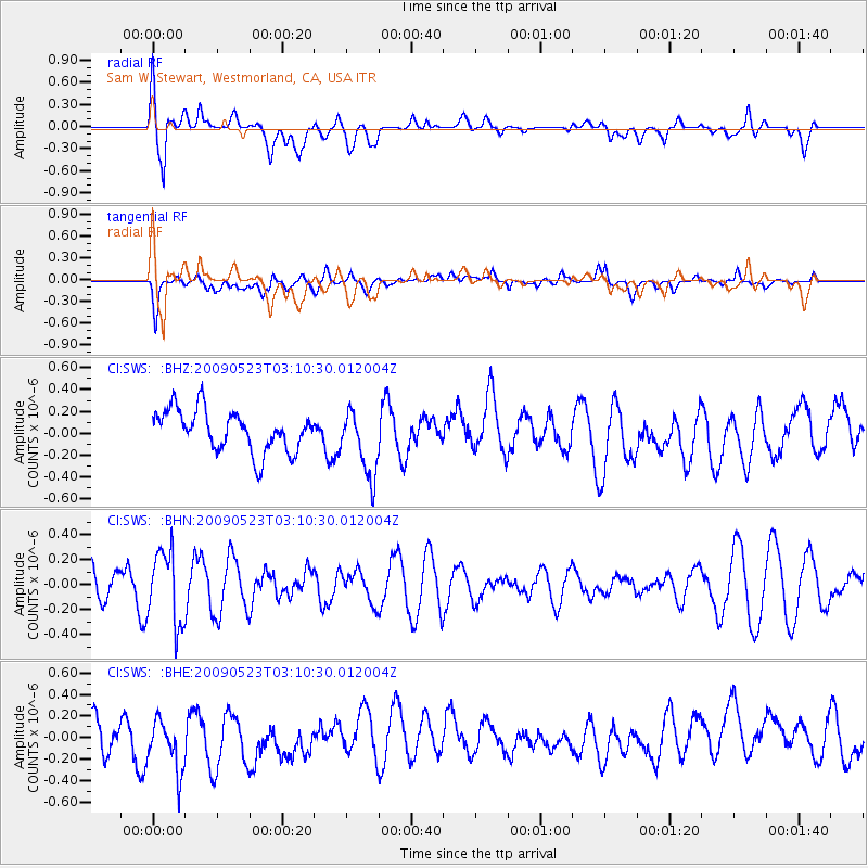
SWS Sam W. Stewart, Westmorland, CA, USA - Earthquake Result Viewer
*The percent match for this event was below the threshold and hence no stack was calculated.
| Earthquake location: |
South Of Fiji Islands |
| Earthquake latitude/longitude: |
-24.4/178.8 |
| Earthquake time(UTC): |
2009/05/23 (143) 02:59:28 GMT |
| Earthquake Depth: |
566 km |
| Earthquake Magnitude: |
5.5 MW, 5.1 MB |
| Earthquake Catalog/Contributor: |
WHDF/NEIC |
|
| Network: |
CI Caltech Regional Seismic Network |
| Station: |
SWS Sam W. Stewart, Westmorland, CA, USA |
| Lat/Lon: |
32.94 N/115.80 W |
| Elevation: |
140 m |
|
| Distance: |
84.4 deg |
| Az: |
50.173 deg |
| Baz: |
236.386 deg |
| Ray Param: |
$rayparam |
*The percent match for this event was below the threshold and hence was not used in the summary stack. |
|
| Radial Match: |
55.957973 % |
| Radial Bump: |
400 |
| Transverse Match: |
54.45126 % |
| Transverse Bump: |
400 |
| SOD ConfigId: |
2648 |
| Insert Time: |
2010-03-05 20:37:05.631 +0000 |
| GWidth: |
2.5 |
| Max Bumps: |
400 |
| Tol: |
0.001 |
|
Signal To Noise
| Channel | StoN | STA | LTA |
| CI:SWS: :BHN:20090523T03:10:30.012004Z | 1.9365628 | 2.9091495E-7 | 1.5022232E-7 |
| CI:SWS: :BHE:20090523T03:10:30.012004Z | 0.9590776 | 2.6305935E-7 | 2.742837E-7 |
| CI:SWS: :BHZ:20090523T03:10:30.012004Z | 1.6224743 | 3.0466526E-7 | 1.8777818E-7 |
| Arrivals |
| Ps | |
| PpPs | |
| PsPs/PpSs | |


