You are here: Home > Network List > CI - Caltech Regional Seismic Network Stations List
> Station SWS Sam W. Stewart, Westmorland, CA, USA > Earthquake Result Viewer
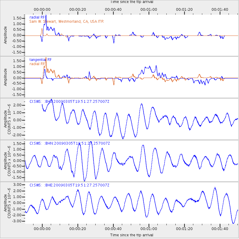
SWS Sam W. Stewart, Westmorland, CA, USA - Earthquake Result Viewer
*The percent match for this event was below the threshold and hence no stack was calculated.
| Earthquake location: |
North Of Svalbard |
| Earthquake latitude/longitude: |
80.3/-1.8 |
| Earthquake time(UTC): |
2009/03/05 (064) 19:41:40 GMT |
| Earthquake Depth: |
10 km |
| Earthquake Magnitude: |
5.5 MB, 5.0 MS, 5.4 MW |
| Earthquake Catalog/Contributor: |
WHDF/NEIC |
|
| Network: |
CI Caltech Regional Seismic Network |
| Station: |
SWS Sam W. Stewart, Westmorland, CA, USA |
| Lat/Lon: |
32.94 N/115.80 W |
| Elevation: |
140 m |
|
| Distance: |
61.6 deg |
| Az: |
299.146 deg |
| Baz: |
10.162 deg |
| Ray Param: |
$rayparam |
*The percent match for this event was below the threshold and hence was not used in the summary stack. |
|
| Radial Match: |
54.729553 % |
| Radial Bump: |
400 |
| Transverse Match: |
30.548946 % |
| Transverse Bump: |
400 |
| SOD ConfigId: |
2658 |
| Insert Time: |
2010-03-05 20:37:26.299 +0000 |
| GWidth: |
2.5 |
| Max Bumps: |
400 |
| Tol: |
0.001 |
|
Signal To Noise
| Channel | StoN | STA | LTA |
| CI:SWS: :BHN:20090305T19:51:27.257007Z | 0.8155548 | 3.4755556E-7 | 4.2615844E-7 |
| CI:SWS: :BHE:20090305T19:51:27.257007Z | 1.0919802 | 6.808976E-7 | 6.235439E-7 |
| CI:SWS: :BHZ:20090305T19:51:27.257007Z | 2.083328 | 1.8660928E-6 | 8.957268E-7 |
| Arrivals |
| Ps | |
| PpPs | |
| PsPs/PpSs | |


