You are here: Home > Network List > CI - Caltech Regional Seismic Network Stations List
> Station DAN Danby, California, USA > Earthquake Result Viewer
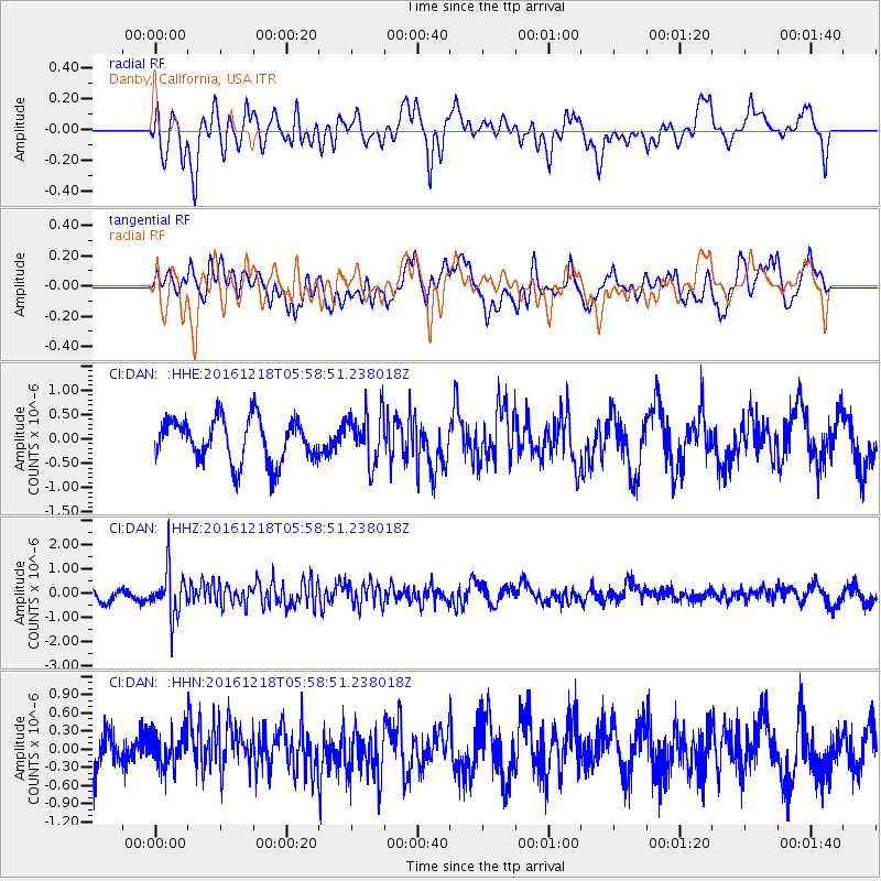
DAN Danby, California, USA - Earthquake Result Viewer
*The percent match for this event was below the threshold and hence no stack was calculated.
| Earthquake location: |
Solomon Islands |
| Earthquake latitude/longitude: |
-10.2/161.2 |
| Earthquake time(UTC): |
2016/12/18 (353) 05:46:25 GMT |
| Earthquake Depth: |
39 km |
| Earthquake Magnitude: |
6.0 Mwp |
| Earthquake Catalog/Contributor: |
NEIC PDE/us |
|
| Network: |
CI Caltech Regional Seismic Network |
| Station: |
DAN Danby, California, USA |
| Lat/Lon: |
34.64 N/115.38 W |
| Elevation: |
398 m |
|
| Distance: |
90.4 deg |
| Az: |
54.999 deg |
| Baz: |
257.923 deg |
| Ray Param: |
$rayparam |
*The percent match for this event was below the threshold and hence was not used in the summary stack. |
|
| Radial Match: |
54.151752 % |
| Radial Bump: |
400 |
| Transverse Match: |
69.317474 % |
| Transverse Bump: |
400 |
| SOD ConfigId: |
11737051 |
| Insert Time: |
2019-04-26 08:34:22.759 +0000 |
| GWidth: |
2.5 |
| Max Bumps: |
400 |
| Tol: |
0.001 |
|
Signal To Noise
| Channel | StoN | STA | LTA |
| CI:DAN: :HHZ:20161218T05:58:51.238018Z | 3.4793215 | 9.702974E-7 | 2.7887543E-7 |
| CI:DAN: :HHN:20161218T05:58:51.238018Z | 0.9541338 | 2.8894294E-7 | 3.0283275E-7 |
| CI:DAN: :HHE:20161218T05:58:51.238018Z | 1.1694245 | 5.2539775E-7 | 4.4927887E-7 |
| Arrivals |
| Ps | |
| PpPs | |
| PsPs/PpSs | |


