You are here: Home > Network List > CI - Caltech Regional Seismic Network Stations List
> Station SWS Sam W. Stewart, Westmorland, CA, USA > Earthquake Result Viewer
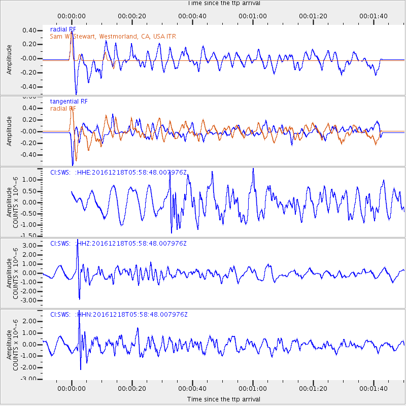
SWS Sam W. Stewart, Westmorland, CA, USA - Earthquake Result Viewer
*The percent match for this event was below the threshold and hence no stack was calculated.
| Earthquake location: |
Solomon Islands |
| Earthquake latitude/longitude: |
-10.2/161.2 |
| Earthquake time(UTC): |
2016/12/18 (353) 05:46:25 GMT |
| Earthquake Depth: |
39 km |
| Earthquake Magnitude: |
6.0 Mwp |
| Earthquake Catalog/Contributor: |
NEIC PDE/us |
|
| Network: |
CI Caltech Regional Seismic Network |
| Station: |
SWS Sam W. Stewart, Westmorland, CA, USA |
| Lat/Lon: |
32.94 N/115.80 W |
| Elevation: |
140 m |
|
| Distance: |
89.7 deg |
| Az: |
56.58 deg |
| Baz: |
257.691 deg |
| Ray Param: |
$rayparam |
*The percent match for this event was below the threshold and hence was not used in the summary stack. |
|
| Radial Match: |
52.06871 % |
| Radial Bump: |
400 |
| Transverse Match: |
57.28173 % |
| Transverse Bump: |
400 |
| SOD ConfigId: |
11737051 |
| Insert Time: |
2019-04-26 08:34:56.684 +0000 |
| GWidth: |
2.5 |
| Max Bumps: |
400 |
| Tol: |
0.001 |
|
Signal To Noise
| Channel | StoN | STA | LTA |
| CI:SWS: :HHZ:20161218T05:58:48.007976Z | 4.9230766 | 1.2560538E-6 | 2.5513594E-7 |
| CI:SWS: :HHN:20161218T05:58:48.007976Z | 2.718642 | 9.258881E-7 | 3.4057007E-7 |
| CI:SWS: :HHE:20161218T05:58:48.007976Z | 1.1854727 | 5.562016E-7 | 4.6918126E-7 |
| Arrivals |
| Ps | |
| PpPs | |
| PsPs/PpSs | |


