You are here: Home > Network List > CN - Canadian National Seismograph Network Stations List
> Station INK INUVIK, NT > Earthquake Result Viewer
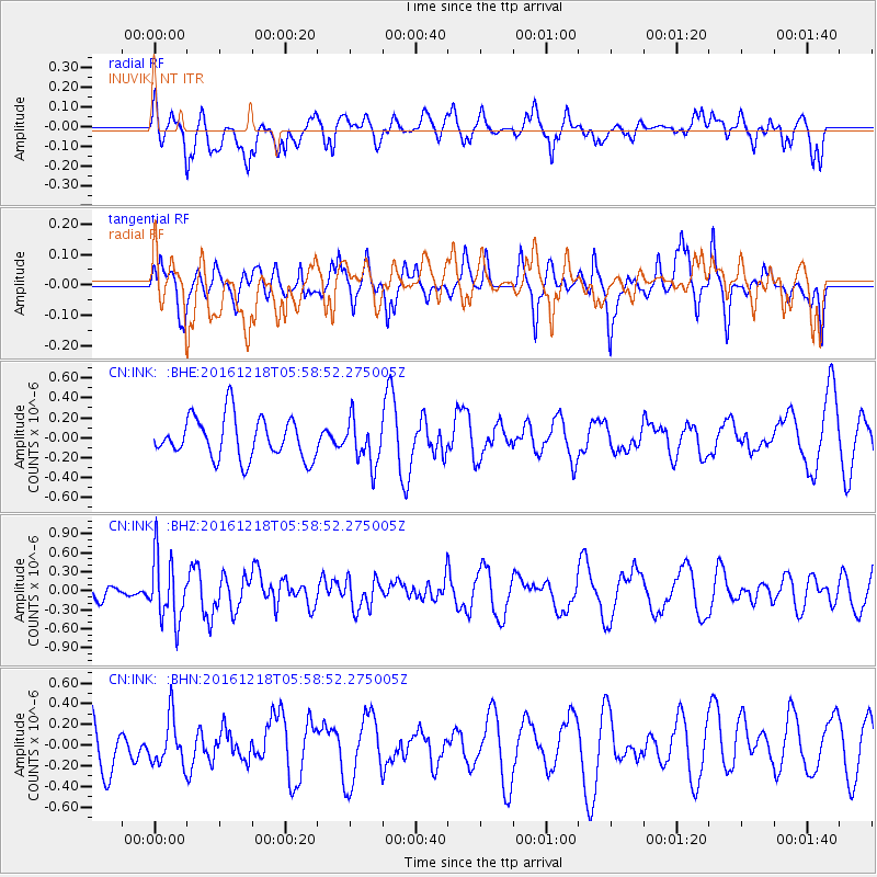
INK INUVIK, NT - Earthquake Result Viewer
*The percent match for this event was below the threshold and hence no stack was calculated.
| Earthquake location: |
Solomon Islands |
| Earthquake latitude/longitude: |
-10.2/161.2 |
| Earthquake time(UTC): |
2016/12/18 (353) 05:46:25 GMT |
| Earthquake Depth: |
39 km |
| Earthquake Magnitude: |
6.0 Mwp |
| Earthquake Catalog/Contributor: |
NEIC PDE/us |
|
| Network: |
CN Canadian National Seismograph Network |
| Station: |
INK INUVIK, NT |
| Lat/Lon: |
68.31 N/133.53 W |
| Elevation: |
44 m |
|
| Distance: |
90.6 deg |
| Az: |
19.739 deg |
| Baz: |
243.401 deg |
| Ray Param: |
$rayparam |
*The percent match for this event was below the threshold and hence was not used in the summary stack. |
|
| Radial Match: |
69.580475 % |
| Radial Bump: |
400 |
| Transverse Match: |
45.974632 % |
| Transverse Bump: |
353 |
| SOD ConfigId: |
11737051 |
| Insert Time: |
2019-04-26 08:35:10.106 +0000 |
| GWidth: |
2.5 |
| Max Bumps: |
400 |
| Tol: |
0.001 |
|
Signal To Noise
| Channel | StoN | STA | LTA |
| CN:INK: :BHZ:20161218T05:58:52.275005Z | 2.1997588 | 5.0544435E-7 | 2.2977262E-7 |
| CN:INK: :BHN:20161218T05:58:52.275005Z | 1.0125545 | 2.3253098E-7 | 2.2964787E-7 |
| CN:INK: :BHE:20161218T05:58:52.275005Z | 1.0705678 | 2.2176555E-7 | 2.071476E-7 |
| Arrivals |
| Ps | |
| PpPs | |
| PsPs/PpSs | |


