You are here: Home > Network List > CI - Caltech Regional Seismic Network Stations List
> Station SWS Sam W. Stewart, Westmorland, CA, USA > Earthquake Result Viewer
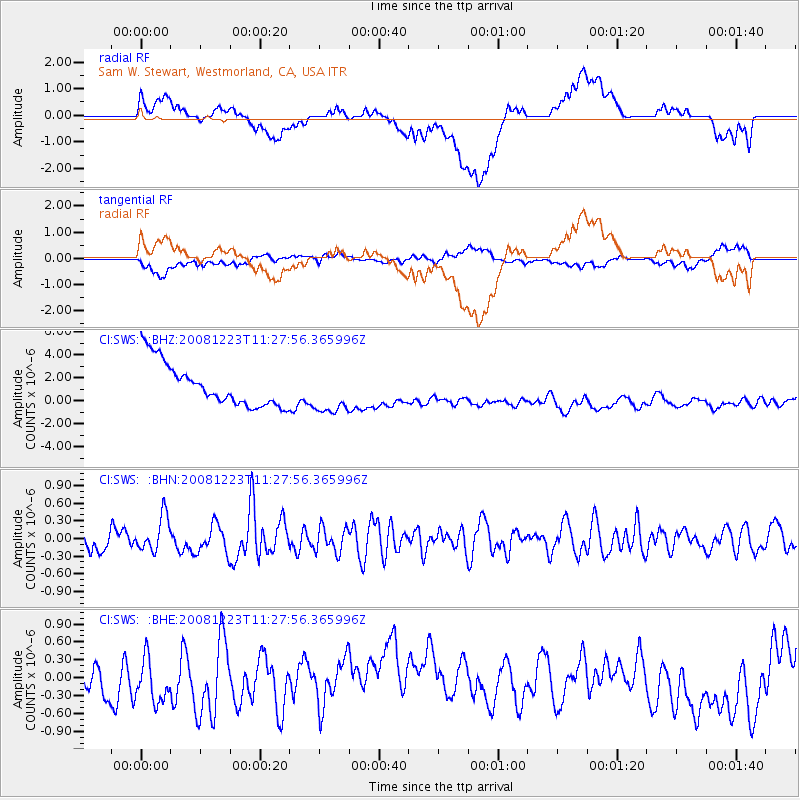
SWS Sam W. Stewart, Westmorland, CA, USA - Earthquake Result Viewer
*The percent match for this event was below the threshold and hence no stack was calculated.
| Earthquake location: |
Solomon Islands |
| Earthquake latitude/longitude: |
-6.4/154.9 |
| Earthquake time(UTC): |
2008/12/23 (358) 11:15:18 GMT |
| Earthquake Depth: |
32 km |
| Earthquake Magnitude: |
5.8 MB, 5.6 MS, 5.9 MW, 5.9 MW |
| Earthquake Catalog/Contributor: |
WHDF/NEIC |
|
| Network: |
CI Caltech Regional Seismic Network |
| Station: |
SWS Sam W. Stewart, Westmorland, CA, USA |
| Lat/Lon: |
32.94 N/115.80 W |
| Elevation: |
140 m |
|
| Distance: |
92.8 deg |
| Az: |
57.334 deg |
| Baz: |
264.28 deg |
| Ray Param: |
$rayparam |
*The percent match for this event was below the threshold and hence was not used in the summary stack. |
|
| Radial Match: |
29.982409 % |
| Radial Bump: |
400 |
| Transverse Match: |
34.49666 % |
| Transverse Bump: |
400 |
| SOD ConfigId: |
2658 |
| Insert Time: |
2010-03-05 20:38:06.539 +0000 |
| GWidth: |
2.5 |
| Max Bumps: |
400 |
| Tol: |
0.001 |
|
Signal To Noise
| Channel | StoN | STA | LTA |
| CI:SWS: :BHN:20081223T11:27:56.365996Z | 1.2942595 | 2.9739434E-7 | 2.2977952E-7 |
| CI:SWS: :BHE:20081223T11:27:56.365996Z | 0.657805 | 5.6096206E-7 | 8.527786E-7 |
| CI:SWS: :BHZ:20081223T11:27:56.365996Z | 1.0568849 | 1.9741622E-6 | 1.8679066E-6 |
| Arrivals |
| Ps | |
| PpPs | |
| PsPs/PpSs | |


