You are here: Home > Network List > CI - Caltech Regional Seismic Network Stations List
> Station SWS Sam W. Stewart, Westmorland, CA, USA > Earthquake Result Viewer
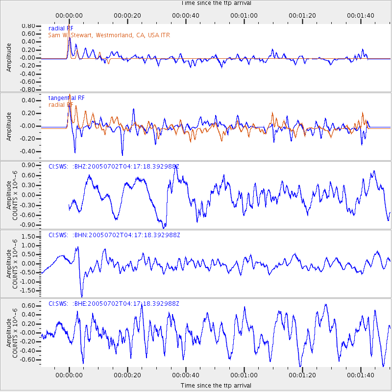
SWS Sam W. Stewart, Westmorland, CA, USA - Earthquake Result Viewer
*The percent match for this event was below the threshold and hence no stack was calculated.
| Earthquake location: |
Near Coast Of Nicaragua |
| Earthquake latitude/longitude: |
11.4/-86.3 |
| Earthquake time(UTC): |
2005/07/02 (183) 04:11:04 GMT |
| Earthquake Depth: |
40 km |
| Earthquake Magnitude: |
5.4 MB, 5.4 MS, 5.8 MW, 5.0 MD |
| Earthquake Catalog/Contributor: |
WHDF/NEIC |
|
| Network: |
CI Caltech Regional Seismic Network |
| Station: |
SWS Sam W. Stewart, Westmorland, CA, USA |
| Lat/Lon: |
32.94 N/115.80 W |
| Elevation: |
140 m |
|
| Distance: |
34.5 deg |
| Az: |
313.018 deg |
| Baz: |
121.512 deg |
| Ray Param: |
$rayparam |
*The percent match for this event was below the threshold and hence was not used in the summary stack. |
|
| Radial Match: |
77.92099 % |
| Radial Bump: |
400 |
| Transverse Match: |
80.90648 % |
| Transverse Bump: |
400 |
| SOD ConfigId: |
3128 |
| Insert Time: |
2010-03-05 20:38:16.371 +0000 |
| GWidth: |
2.5 |
| Max Bumps: |
400 |
| Tol: |
0.001 |
|
Signal To Noise
| Channel | StoN | STA | LTA |
| CI:SWS: :BHN:20050702T04:17:18.392988Z | 3.159398 | 7.8687026E-7 | 2.4905702E-7 |
| CI:SWS: :BHE:20050702T04:17:18.392988Z | 1.6590171 | 2.758541E-7 | 1.6627563E-7 |
| CI:SWS: :BHZ:20050702T04:17:18.392988Z | 1.8876756 | 6.830356E-7 | 3.618395E-7 |
| Arrivals |
| Ps | |
| PpPs | |
| PsPs/PpSs | |


