You are here: Home > Network List > CI - Caltech Regional Seismic Network Stations List
> Station SWS Sam W. Stewart, Westmorland, CA, USA > Earthquake Result Viewer
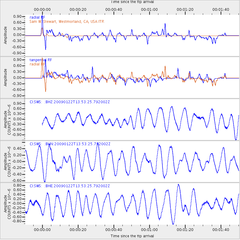
SWS Sam W. Stewart, Westmorland, CA, USA - Earthquake Result Viewer
*The percent match for this event was below the threshold and hence no stack was calculated.
| Earthquake location: |
New Britain Region, P.N.G. |
| Earthquake latitude/longitude: |
-5.9/148.5 |
| Earthquake time(UTC): |
2009/01/22 (022) 13:40:25 GMT |
| Earthquake Depth: |
44 km |
| Earthquake Magnitude: |
5.6 MB, 5.7 MS, 6.1 MW, 6.0 MW |
| Earthquake Catalog/Contributor: |
WHDF/NEIC |
|
| Network: |
CI Caltech Regional Seismic Network |
| Station: |
SWS Sam W. Stewart, Westmorland, CA, USA |
| Lat/Lon: |
32.94 N/115.80 W |
| Elevation: |
140 m |
|
| Distance: |
98.0 deg |
| Az: |
57.658 deg |
| Baz: |
268.112 deg |
| Ray Param: |
$rayparam |
*The percent match for this event was below the threshold and hence was not used in the summary stack. |
|
| Radial Match: |
69.73483 % |
| Radial Bump: |
400 |
| Transverse Match: |
58.746433 % |
| Transverse Bump: |
400 |
| SOD ConfigId: |
2658 |
| Insert Time: |
2010-03-05 20:38:17.073 +0000 |
| GWidth: |
2.5 |
| Max Bumps: |
400 |
| Tol: |
0.001 |
|
Signal To Noise
| Channel | StoN | STA | LTA |
| CI:SWS: :BHN:20090122T13:53:25.792002Z | 2.047284 | 4.1089044E-7 | 2.0070028E-7 |
| CI:SWS: :BHE:20090122T13:53:25.792002Z | 0.9702224 | 3.9978653E-7 | 4.1205655E-7 |
| CI:SWS: :BHZ:20090122T13:53:25.792002Z | 0.7572491 | 1.7937508E-7 | 2.3687724E-7 |
| Arrivals |
| Ps | |
| PpPs | |
| PsPs/PpSs | |


