You are here: Home > Network List > TA - USArray Transportable Network (new EarthScope stations) Stations List
> Station A21K Barrow, AK, USA > Earthquake Result Viewer
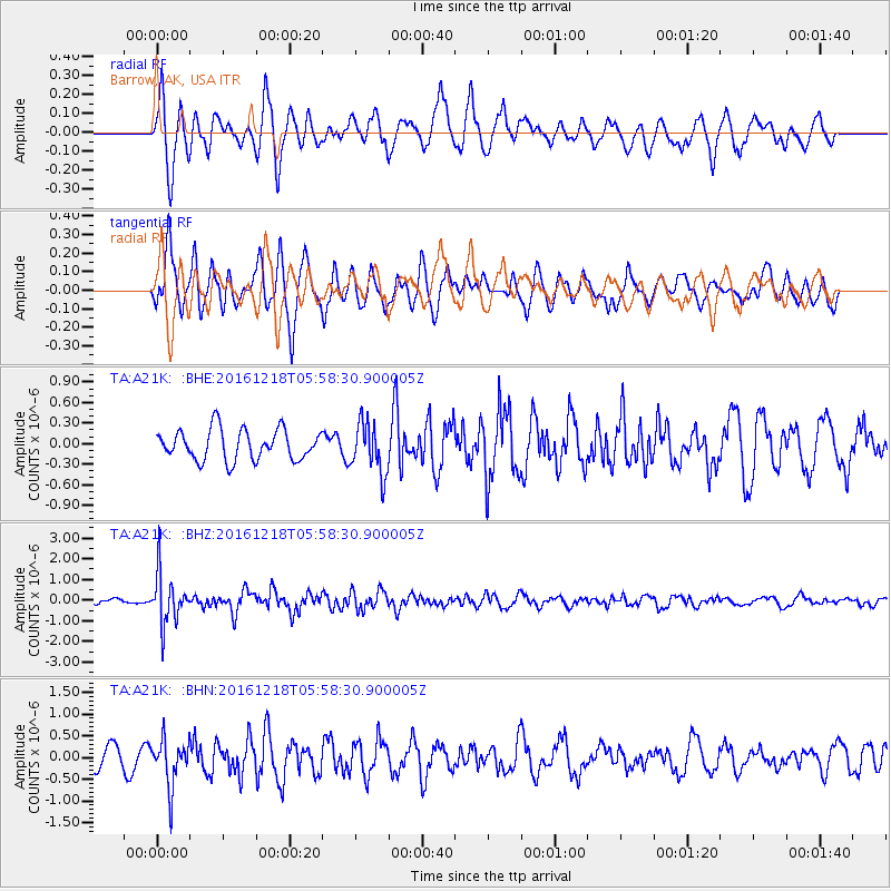
A21K Barrow, AK, USA - Earthquake Result Viewer
*The percent match for this event was below the threshold and hence no stack was calculated.
| Earthquake location: |
Solomon Islands |
| Earthquake latitude/longitude: |
-10.2/161.2 |
| Earthquake time(UTC): |
2016/12/18 (353) 05:46:25 GMT |
| Earthquake Depth: |
39 km |
| Earthquake Magnitude: |
6.0 Mwp |
| Earthquake Catalog/Contributor: |
NEIC PDE/us |
|
| Network: |
TA USArray Transportable Network (new EarthScope stations) |
| Station: |
A21K Barrow, AK, USA |
| Lat/Lon: |
71.32 N/156.62 W |
| Elevation: |
577 m |
|
| Distance: |
86.1 deg |
| Az: |
12.525 deg |
| Baz: |
221.495 deg |
| Ray Param: |
$rayparam |
*The percent match for this event was below the threshold and hence was not used in the summary stack. |
|
| Radial Match: |
64.89964 % |
| Radial Bump: |
400 |
| Transverse Match: |
64.22008 % |
| Transverse Bump: |
400 |
| SOD ConfigId: |
11737051 |
| Insert Time: |
2019-04-26 08:37:29.380 +0000 |
| GWidth: |
2.5 |
| Max Bumps: |
400 |
| Tol: |
0.001 |
|
Signal To Noise
| Channel | StoN | STA | LTA |
| TA:A21K: :BHZ:20161218T05:58:30.900005Z | 9.487152 | 1.2124324E-6 | 1.2779729E-7 |
| TA:A21K: :BHN:20161218T05:58:30.900005Z | 1.867947 | 5.4177826E-7 | 2.9003942E-7 |
| TA:A21K: :BHE:20161218T05:58:30.900005Z | 1.6878259 | 3.7355377E-7 | 2.2132245E-7 |
| Arrivals |
| Ps | |
| PpPs | |
| PsPs/PpSs | |


