You are here: Home > Network List > CI - Caltech Regional Seismic Network Stations List
> Station SWS Sam W. Stewart, Westmorland, CA, USA > Earthquake Result Viewer
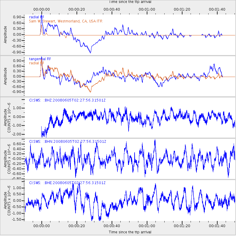
SWS Sam W. Stewart, Westmorland, CA, USA - Earthquake Result Viewer
*The percent match for this event was below the threshold and hence no stack was calculated.
| Earthquake location: |
West Chile Rise |
| Earthquake latitude/longitude: |
-38.8/-91.6 |
| Earthquake time(UTC): |
2008/06/05 (157) 02:16:46 GMT |
| Earthquake Depth: |
10 km |
| Earthquake Magnitude: |
5.6 MS, 5.4 MB, 6.0 MW, 6.0 MW |
| Earthquake Catalog/Contributor: |
WHDF/NEIC |
|
| Network: |
CI Caltech Regional Seismic Network |
| Station: |
SWS Sam W. Stewart, Westmorland, CA, USA |
| Lat/Lon: |
32.94 N/115.80 W |
| Elevation: |
140 m |
|
| Distance: |
74.9 deg |
| Az: |
339.102 deg |
| Baz: |
160.655 deg |
| Ray Param: |
$rayparam |
*The percent match for this event was below the threshold and hence was not used in the summary stack. |
|
| Radial Match: |
52.75641 % |
| Radial Bump: |
400 |
| Transverse Match: |
54.868473 % |
| Transverse Bump: |
400 |
| SOD ConfigId: |
2504 |
| Insert Time: |
2010-03-05 20:38:41.452 +0000 |
| GWidth: |
2.5 |
| Max Bumps: |
400 |
| Tol: |
0.001 |
|
Signal To Noise
| Channel | StoN | STA | LTA |
| CI:SWS: :BHN:20080605T02:27:56.31501Z | 0.78534925 | 2.1550393E-7 | 2.744052E-7 |
| CI:SWS: :BHE:20080605T02:27:56.31501Z | 0.9994898 | 3.764988E-7 | 3.76691E-7 |
| CI:SWS: :BHZ:20080605T02:27:56.31501Z | 0.84906125 | 6.525166E-7 | 7.685153E-7 |
| Arrivals |
| Ps | |
| PpPs | |
| PsPs/PpSs | |


