You are here: Home > Network List > UW - Pacific Northwest Regional Seismic Network Stations List
> Station HOOD Mt Hood Meadows, OR CREST BB SMO > Earthquake Result Viewer
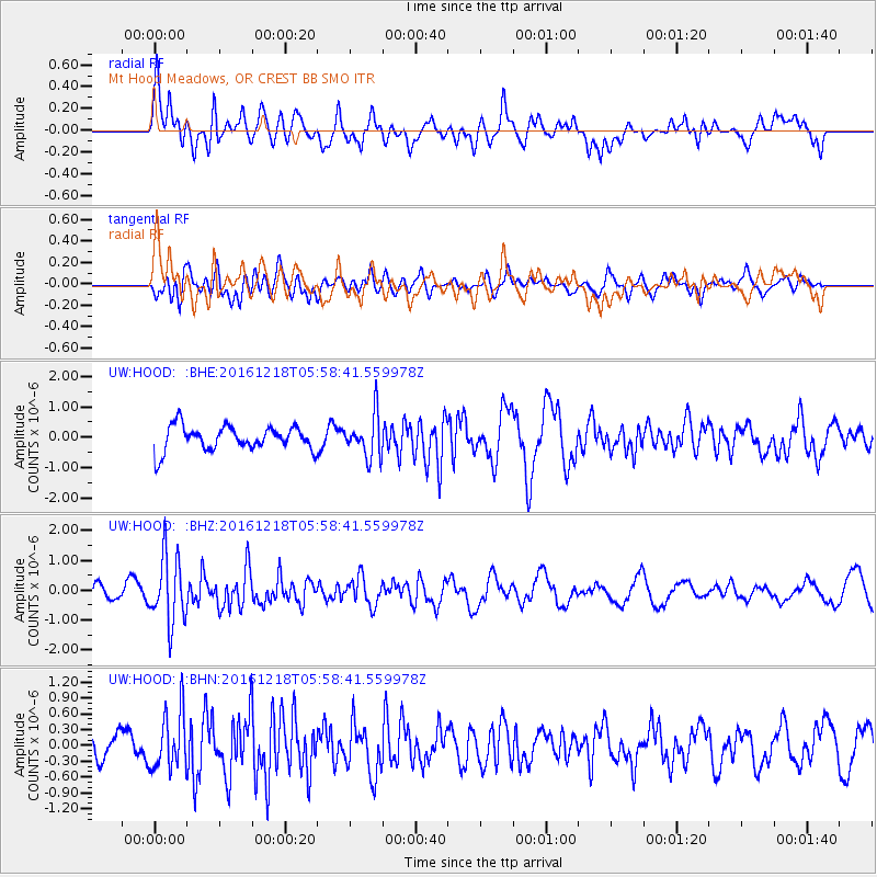
HOOD Mt Hood Meadows, OR CREST BB SMO - Earthquake Result Viewer
*The percent match for this event was below the threshold and hence no stack was calculated.
| Earthquake location: |
Solomon Islands |
| Earthquake latitude/longitude: |
-10.2/161.2 |
| Earthquake time(UTC): |
2016/12/18 (353) 05:46:25 GMT |
| Earthquake Depth: |
39 km |
| Earthquake Magnitude: |
6.0 Mwp |
| Earthquake Catalog/Contributor: |
NEIC PDE/us |
|
| Network: |
UW Pacific Northwest Regional Seismic Network |
| Station: |
HOOD Mt Hood Meadows, OR CREST BB SMO |
| Lat/Lon: |
45.32 N/121.65 W |
| Elevation: |
1520 m |
|
| Distance: |
88.3 deg |
| Az: |
43.483 deg |
| Baz: |
253.758 deg |
| Ray Param: |
$rayparam |
*The percent match for this event was below the threshold and hence was not used in the summary stack. |
|
| Radial Match: |
63.453266 % |
| Radial Bump: |
400 |
| Transverse Match: |
57.51962 % |
| Transverse Bump: |
400 |
| SOD ConfigId: |
11737051 |
| Insert Time: |
2019-04-26 08:39:08.097 +0000 |
| GWidth: |
2.5 |
| Max Bumps: |
400 |
| Tol: |
0.001 |
|
Signal To Noise
| Channel | StoN | STA | LTA |
| UW:HOOD: :BHZ:20161218T05:58:41.559978Z | 4.3274016 | 1.1186803E-6 | 2.5851082E-7 |
| UW:HOOD: :BHN:20161218T05:58:41.559978Z | 2.022309 | 5.4192105E-7 | 2.6797144E-7 |
| UW:HOOD: :BHE:20161218T05:58:41.559978Z | 1.7210618 | 6.8950396E-7 | 4.0062707E-7 |
| Arrivals |
| Ps | |
| PpPs | |
| PsPs/PpSs | |


